Kontakt / contact     Hauptseite / page
                  principale / pagina principal / home     zurück / retour /
                  indietro / atrás / back
<<         >>
D  

Vietnam: Ho Chi Minh Trail 4:  History and resistance - against China and France

described by Khôi and Giói

Nguyên
-- routed 50,000 Siamese troops in Rach Gâm (Xoài Mút) and
-- defeated over 200,000 Qing troops in Thang Long,
-- adding glorious pages to the history of Viêt Nam. (p.41)


Province "Thanh Hoa", ruler Lê Loi   Lam Son
                    rebellion, map    King Quang Trung (alias Nguyen
                      Hue) with an elephant army   king Quang
                        Trung, statue
Province "Thanh Hoa", ruler Lê Loi [9] - Lam Son rebellion, map [10]

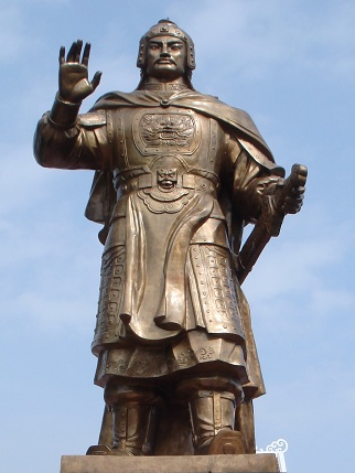
King Quang Trung (alias Nguyen Hue) with an elephant army [15] - king Quang Trung, statue [16]

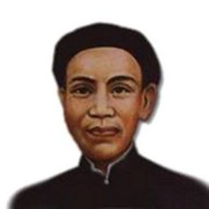
Phan Đình Phùng,
                  rebel leader against criminal French
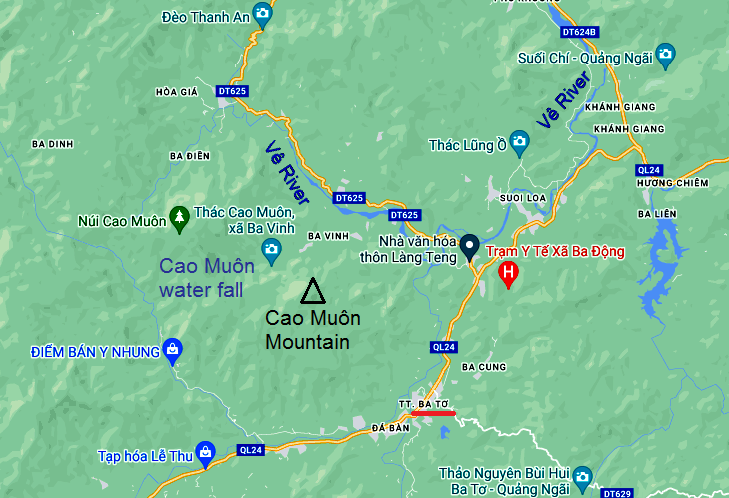
                  "Christians"    Map: town of Quang Ngai with Vê River and Cao
                      Môn Mountain (Vietnamese: Núi Cao Muôn)   Vietnam, the village
                          of "Ba To", rebel center since 1945
                          against criminal "Christians" from
                          France and "USA"   victory monument against criminal French
                          "Christians" and against criminal
                          Rothschild NATO, "USA" and their
                          "befriended states"
Phan Đình Phùng, rebel leader against criminal French "Christians" [17]

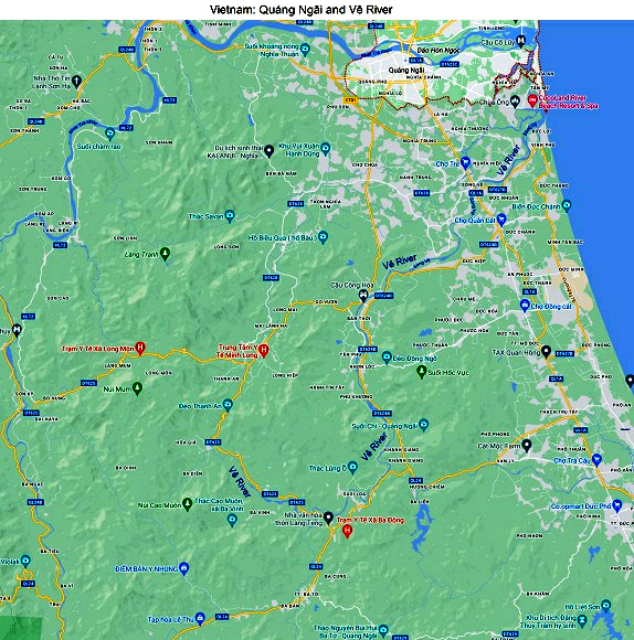
Map: town of Quang Ngai with Vê River and Cao Môn Mountain (Vietnamese: Núi  Cao Muôn) [37]
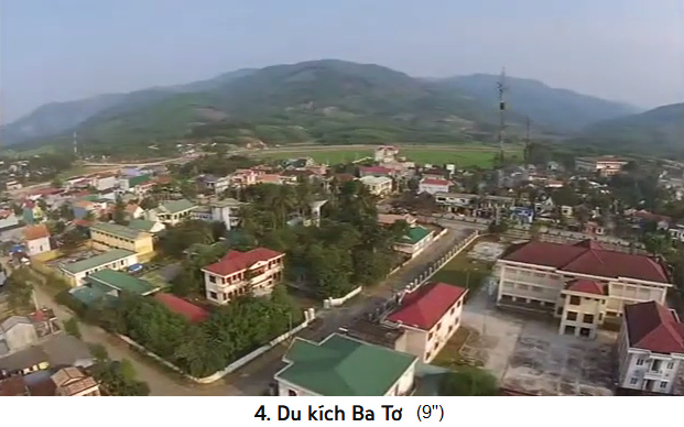
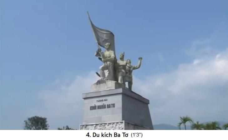
Vietnam, the village of "Ba To", rebel center since 1945 against criminal "Christians" from France and "USA" [41] - victory monument against criminal French "Christians" and against criminal Rothschild NATO, "USA" and their "befriended states" [42]


presented by
Michael Palomino (2013)

Share:

Facebook


from: The Hô Chí Minh Trail; Hoàng Khôi and Thê Giói Publishers 2008; English translation; first edition 2001; second edition 2008; printed in Viêt Nam; VN - TG - 6.149-1

4  Historical significance and tradition of resistance - [against China and France]

<The tourist has admired the wild beauty of [the mountain range of] Truòng Son and participated in the festivities of the Truòng Son people. He has discovered many exotic features of the simple life of the local ethnic minorities. Now we would like to invite him to get a glimpse of the history of the Vietnamese people, which is closely associated with the Truòng Son range.> (p.37)

[Hier ist die Festung von Vietnam: die Gebirgskette 1000km lang - mit 6 Monaten heissem Klima und 6 Monaten Überschwemmungen]:

Vietnamese
                        fortress: 1000km of mountain range "Truong
                        Son"
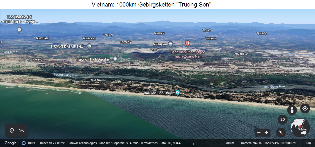
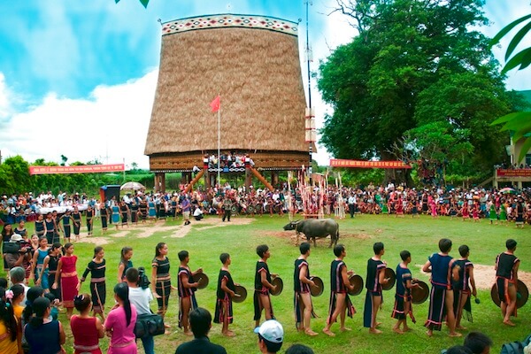
Vietnamese fortress: 1000km of mountain range "Truong Son" [0]


[6 months rain - 6 months dry season - stories about wild animals - retreat area]

<Due to its position and geographical conditions, [the mountain range of] Truòng Son is convenient for fighting foreign invaders but it makes production difficult. there are 6 months of continuous rain and 6 months of scorching sun each year; it combines the unwholesome climate of deserted mountains and forests with an abundance of wild, ferocious animals, leading to lots of mysterious and horrible stories. Yet, [the mountain range of] Truòng Son is the backbone of the Vietnamese people during periods of historical upheavals.> (p.37)

[Van An Citadel against Tang and Ming of China]

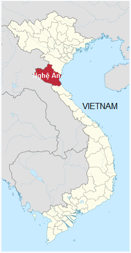
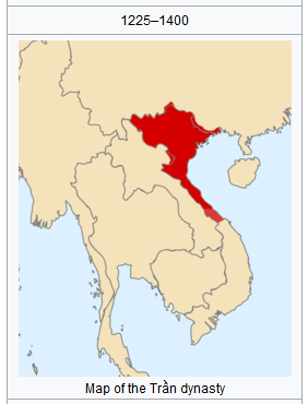
<In 722, the Vietnamese relied on the Dun mountains, a branch of the Giang Màn Range in Western Nghê An, to build the Van An Citadel (p.37) against the Chinese invaders of the Tang dynasty. In 1403, Hô Quy Ly chose the [mountain range of] Truòng Son in Western Nghê An as a base to oppose (Chinese) Ming aggressors. The later Trân Dynasty (14th century) also used Western Nghê An as a base to muster forces to restore dynastic power.> (p.38)

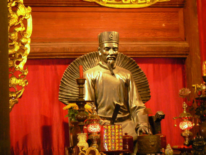
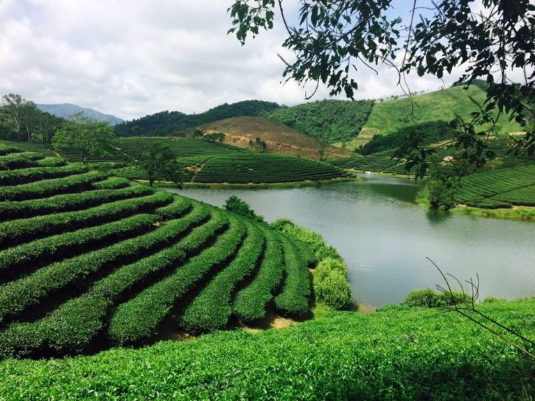
Map of Vietnam with Nghê An Province   map of Trân Dynasty 1225 to 1400   Professor Chu Van An, golden statue   Province "Nghê An", tea
                          fields
Map of Vietnam with Nghê An Province [1] - map of Trân Dynasty 1225 to 1400 [2] - Professor Chu Van An, golden statue [3]
Province "Nghê An", tea fields [4]

"Nghê An" province, a
                        mountain village   "Nghê An" province, Cuong
                        temple   a Thai native
                        woman in traditional clothes at Chao La
                        waterfall
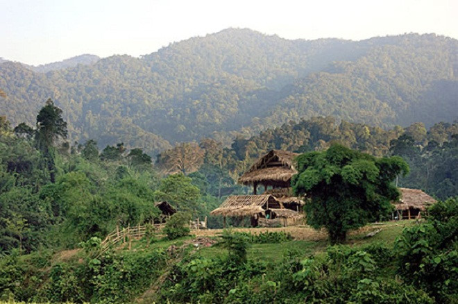
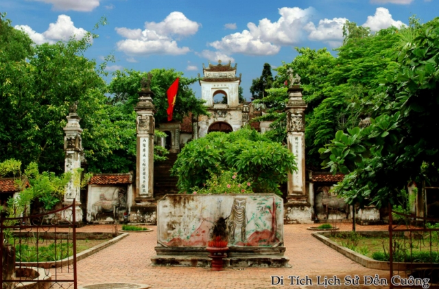
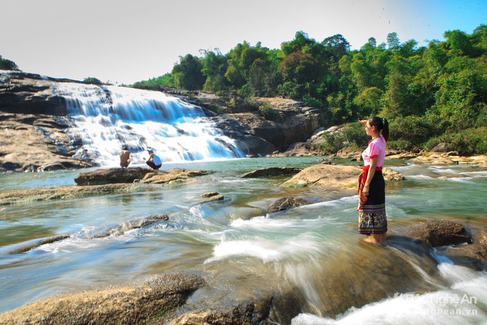
"Nghê An" province, a mountain village [5] - "Nghê An" province, Cuong temple [6] - a Thai native woman in traditional clothes at Chao La waterfall [7]

Provinz "Nghê An" Link (vietnamesisch)

[Vietnamese Lê Dynasty defeating Chinese Ming dynasty]

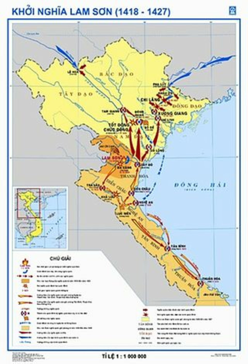
<Then Lê Loi, a powerful man of the Lam Son region (Than Hóa province) staged a 10-year insurrection against the (Chinese) Ming invaders. He recovered national independence, and set up the Le Dynasty which lasted nearly 500 years. The Lam Son insurrectionists (link (English)) relied on Northern Truòng Son to create strategic turning points in the fight against the Ming aggressors in the 15th century.

Map of Vietnam with "Thanh
                        Hoa" province   province of "Thanh Hoa",
                        ruler Lê Loi   Lam Son
                        rebellion, map
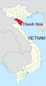
Map of Vietnam with "Thanh Hoa" province [8] - province of "Thanh Hoa", ruler Lê Loi [9] - Lam Son rebellion, map [10]

The battles in Western Truòng Son (Nghê An), such as the battles of Bù Bang and Trà Lâm , inflicted a shattering defeat on the Ming and deprived them of initiatives. From these battles in Western Nghê An, the Lam Son insurrectionists advanced to liberate Tân Bình, Thuân Hóa and finally forced the Ming to surrender unconditionally.> (p.38)

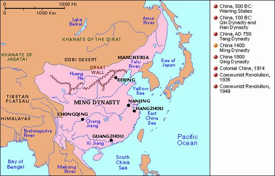
Map of China with Ming dynasty of
                          about 1400  
Map of China with Ming dynasty of about 1400 [11]

[Trung Dô Citadel against Qing Dynasty]

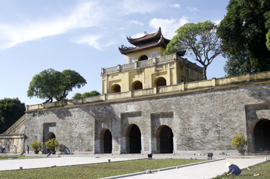
<In 1789, King Quang Trung (Nguyên Huê) reviewed his troops at the foot of the Lam Thành mountain (a branch of the Truòng Son in Nghê An), preparing to go northwards to annihilate the Chinese Qing in Thang Long [citadel of Hanoi]. Nguyên Huê built the Trung Dò Citadel on the Hông Linh mountain (part of the Truòng Son in Nghê Tinh).> (p.38)

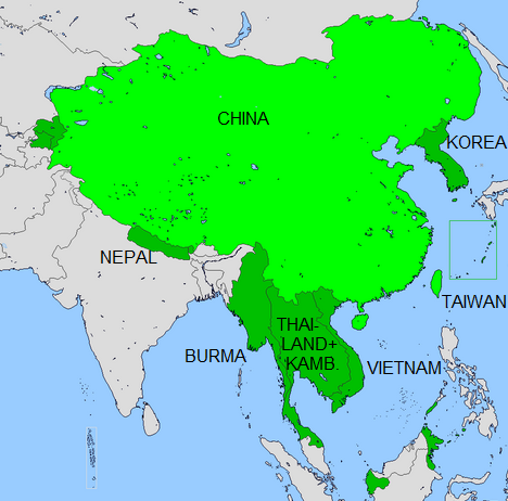
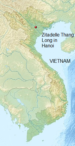
Map of China with Qing Dynasty of 1765   Citadel of "Thang
                          Long" at Hanoi, map   Hanoi,
                          Thang Long citadel
Map of China with Qing Dynasty of 1765 [12] - Citadel of "Thang Long" at Hanoi, map [13] - Hanoi, Thang Long citadel [14]

About King Quang Trung: The King never failed a battle of Vietnam [web01]
Oct 31, 2019 2727
Translation with Deepl:
The ruler Quang Trung (real name Nguyen Hue) [...]. Quang Trung was not only one of the outstanding military generals, but also a talented ruler and realized many outstanding economic and social reforms in Vietnamese history.

King
                                  Quang Trung (alias Nguyen Hue) with an
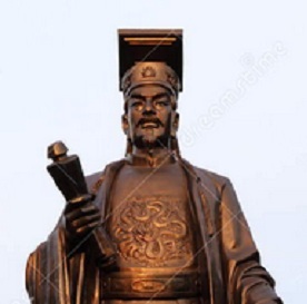
                                  elephant army   King Quang Trung, statue
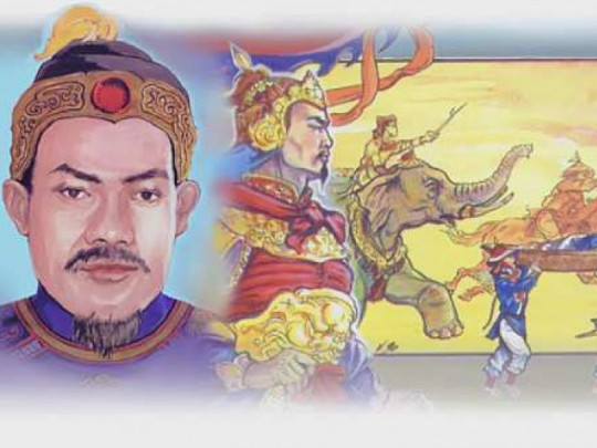
King Quang Trung (alias Nguyen Hue) with an elephant army [15] - King Quang Trung, statue [16]

Nguyen Hue and his two brothers, known as Tay Sohn Tam Kiet, were leaders of the Tay Sohn rebellion. In two campaigns, the situation was clarified as far as Dang Trong and Dang Ngoai were affected. The dispute had lasted for 200 years. Quang Trung also defeated the Chinese invasion of Dai-Viet from the south, and the Chinese northern invasion at Thanh. Since he was 18 years old, he fought in dozens of battles for 20 years and he did not lose one single battle. In 1788, he was able to defeat 20,000 Chinese troops of the Manchu Dynasty in North Vietnam with 10,000 Vietnamese soldiers who wanted to enter Vietnam. Quang Trung has been a national hero since his sudden death at 39 and left his projects to his successors. Today, honorary tombs, temples, monuments and a museum are built throughout the country for commemorating Quang Trung (alias Nguyen Hue). [web01]


Criminal French rulership in Hanoi against Vietnamese culture
Translation with Deepl:
"In 1873, Hanoi was conquered by the French. From 1883 to 1945, the city was the administrative center of the colony of French Indochina. The French built a modern administrative city south of Old Hanoi, installing wide tree-lined avenues at right angles to each other with opera houses, churches, public buildings and luxury villas, but also destroyed large parts of the city, filled in or reduced the size of lakes and canals; imperial palaces and citadel also was destroyed." [web02]


[Resistence against French "Christian" occupation of Vietnam under Phan Dinh Phùng: military base in Vu Quang mountain branch at Hà Tinh]

<The insurrectionist troops of Phan Dình Phùng took the Vu Quang mountain branch of the [mountain range of] Truòng Son in Hà Tinh as the base against the French colonialists from 1885 to 1896.> (p.38)

Phan Đình
                                  Phùng, rebel leader against criminal
                                  French "Christians"  
Phan Đình Phùng, rebel leader against criminal French "Christians" [17]

Mossad Wikipedia says (translation with Deepl):
"Phan Dinh Phung was an official in the Empire of Vietnam and rose in the hierarchy under Emperor Tự Đức. He responded to Emperor Hàm Nghi's call to revolt against the French and organized a guerrilla against the colonial power in his home region. In July 1885, Emperor Ham Nghi proclaimed the uprising against the colonial power when French troops stormed his palace to depose him. Heeding his call, numerous Vietnamese formed loose groups that called themselves "Help the Monarch" (Can Vuong) after the Emperor's edict. Pham Dinh Phung established a guerrilla militia in his home province and fought against the colonial power for about ten years.[2] He reached the climax of his guerrilla campaign in 1893 with an attack on the governor's residence of Nghe An province, which was, however, repulsed by colonial troops. The guerrillas led by Phan never recovered from the defeat. Phan's family and hometown were subjected to reprisals by the colonial state, including the desecration of his ancestors' graves and his family being taken into clan custody.[1] Ten years after the revolt began, he was still leading a force of 1,200 to 1,500 guerrillas.[3] He himself died in the field in the highland forests of Quảng Bình Province in 1896 due to illness.[3] After his death, his followers dispersed.[2]" [web03]


[About 50 caves with secret accesses]

<As mentioned earlier, the Giang Màn range in Nghê An and Hà Tinh contains about 50 caves and grottoes that are used as refuges, supplies storing places and weapons workshops.

Map of Vietnam
                        indicating "Nghê An" province   map of Vietnam with "Hà
                          Tinh" province  
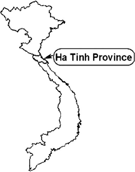
Map of Vietnam indicating "Nghê An" province [1] - map of Vietnam with "Hà Tinh" province [18]


From the Giang Màn, three lanes lead to Hà Tinh town, to Laos, and to Thailand. Without prior knowledge of the region, one cannot find a way to get in or out of it. Otherwise, one can be bogged down in swamps chest-deep in mud. This base has an area that is hundreds of km large, 100 km long at places and 70-80 km wide. (p.39)

During the Nguyên dynasty, patriotic royalist scholars who opposed the French colonialists in the early 19th century set up their posts depending on the rugged terrain in the mountains and valleys. In Southern Truòng Son, insurrectionists were found in the Thuong Dao upper way base of the Tay Son [South Vietnam], from which was kindled the nation-wide peasant war.> (p.39)

[Whuong Dao - An Khê Pass]

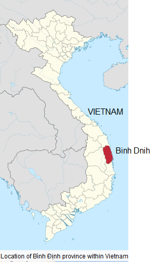
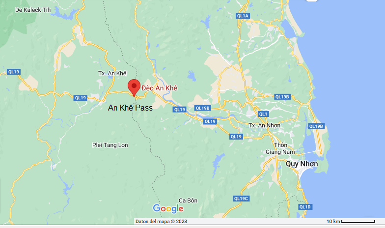
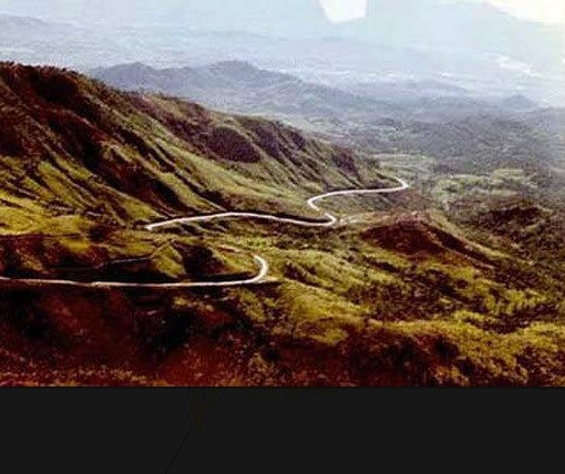
<Whuong Dao is a part of Bình Dinh province with large perennial forests and age-old trees. The An Khê Pass (10 km long) separates Thuong Dao from the eastern provinces of the plain and the Tây Nguyên Pleiku region; access is not easy because of the steep and abrupt stone walls.> (p.39)

Map
                        of Vietnam indicating "Binh Dinh"
                        province in South Vietnam   map with An Khê pass
                          in "Bin Dinh" province   An Keh
                          pass in Vietnam
Map of Vietnam indicating "Binh Dinh" province in South Vietnam [19] - map with An Khê pass in "Bin Dinh" province [20] - An Keh pass in Vietnam [21]


[Central Thuong Dao region]

<Thuong Dao is well-hidden, convenient for the secret establishment of bases and for staging defense forests. It is, however, not isolated. The old communication line from the Qui Nhon plain to Tây Nguyên connects Thuong Dao with two important positions: the Pleiku plateau in the West and the Ha Dao in the East. Occupying Thuong Dao, the insurrectionists could disperse when need be into the forests or withdraw to [the central highlands] "Tây Nguyên" by crossing the steep Mang Gian pass (Sky gate).> (p.39)

Map of Vietnam
                        indicating Pleiku in the Central Highlands   Map indicating the Central Highlands of
                        Vietnam, also called "Tây Nguyên"
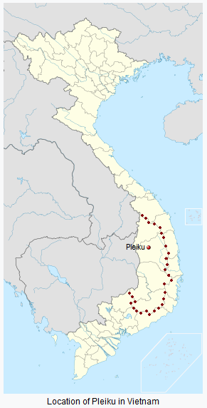
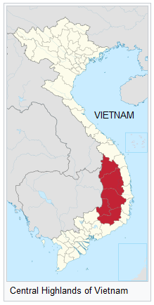
Map of Vietnam indicating Pleiku in the Central Highlands [22] - Map indicating the Central Highlands of Vietnam, also called "Tây Nguyên" [23]

<From Thuong Dao, there are many mountain paths to the northern provinces. Many land and water ways also link Thong Dao to the rice producing region and to the southern provinces. In Thuong Dao, the tourist may see many things associated with the Tây Son brothers. The rock of Nhac (elder-brother) in the De-Cho-Giang village, where he had often passed by and stopped over, is venerated by the Ba Na as a relic of the village.

Vietnam: map indicating the Ba Na natives
                        in the Central Highlands next to other natives   Vietnam: Ba Na natives,
                          drinking ceremony
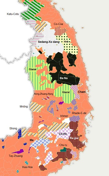
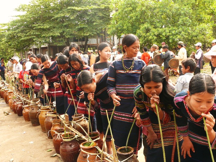
Vietnam: map indicating the Ba Na natives in the Central Highlands next to other natives [24] - Vietnam: Ba Na natives, drinking ceremony [25]


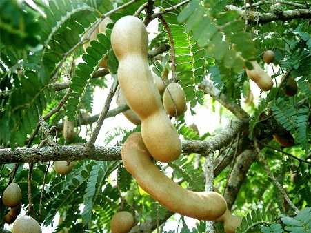
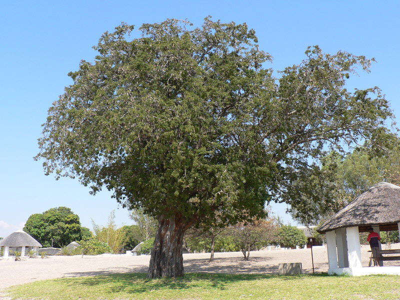
The people of "Sâu" village, Dê Chê region, worship a sack of rice and a sack of salt (distributed by Nhac). At Tu Thuy village there is a large field area called "the field of Dame Hâu", a Ba Na woman and the wife of Nguyên Nhac. Dame Hâu looked after the food production of the region. There still exists the Tây Son brothers' family garden, with a big tamarind tree giving shade and fruits aplenty.> (p.40)

Tamarind tree, pinnas and fruits   Tamarind tree
Tamarind tree, pinnas and fruits [26] - Tamarind tree [27]

[Ông Bình and Ông Nhac mountains]

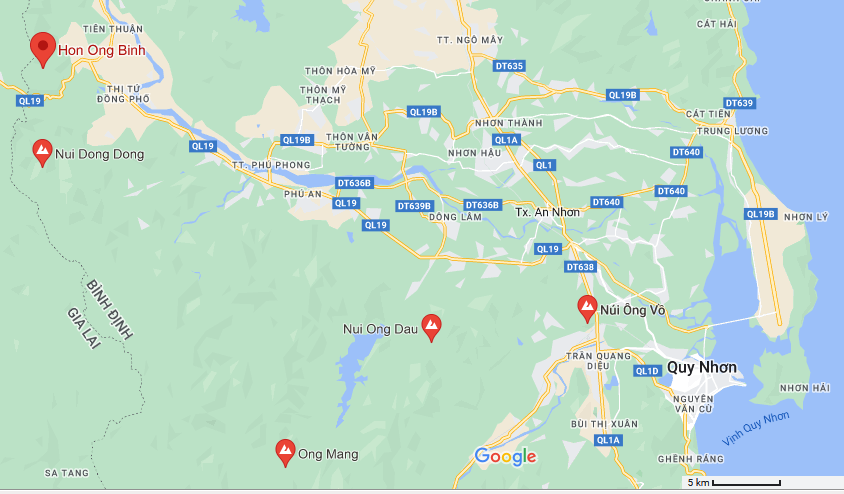
<The Ông Bình (Nguyên Huê) and Ông Nhac mountains in the Máng Pass system leave many vestiges of the Tây Son insurrections which originated from the Tây Son mountains of the Truông Son range. The Ông Bình mountain is 800 m high, the Ông Nhac mountain is a little lower and smaller. They bar the Máng Pass in the North and are connected by a huge system of earthen walls which must have been very difficult to cross over, given the weapons and material of that time.> (p.40)

Vietnam: map indicating the Ong Binh
                        Mountain (Vietnamese: Hon Ong Binh)  
Vietnam: map indicating the Ong Binh Mountain (Vietnamese: Hon Ong Binh) [28]

Vietnam: map
                          indicating Mang Pass and Ong Binh Mountain
Vietnam: map indicating Mang Pass and Ong Binh Mountain [29]


[Fortress of "President" Diem on Ông Bình mountain]

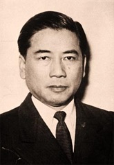
<When Ngô Dình Diêm was "President" of South Viêt Nam (1954-1963)

Dictator Diem from
                          South Vietnam 1954-1963, portrait
Dictator Diem from South Vietnam 1954-1963, portrait [30]

he had fortifications built on the Ông Bình mountain. Many military posts and ramparts were destroyed for making roads, Now only a 350 m portion of the rampart is left, but the tourist can imagine its imposing dimensions because it is 11 m high at the adjoining place of the (p.40) two mountains.> (p.41)

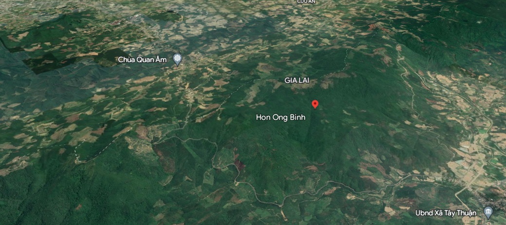
Ong Binh
                        Mountain in Vietnam, inclined aerial view with
                        google Earth
Ong Binh Mountain in Vietnam, inclined aerial view with google Earth [31]

[Ông Bình mountain during the period of Nguyên Nhac 1778-1802]

Surrounding the Ông Bình and Ông Nhac mountains are the L
ãnh Luong mountains where supplies were stored and the Ân Son and Kiêm Son mountains where Nguyên Nhac is thought to have recovered from the Sky his stamp and sword. From this area, the Tây Son insurrectionists went down to liberate the plains and to wage the war of the "peasants clad-in-plain-clothes-and-bearing-the-red-banner." The war, which lasted 24 years (1778-1802) under the leadership of the Tây Son brothers, overthrew the corrupt feudalistic clique Trinh - Nguyên
-- routed 50,000 Siamese troops in Rach Gâm (Xoài Mút) and
-- defeated over 200,000 Qing troops in Thang Long,
-- adding glorious pages to the history of Viêt Nam. (p.41)

[The defense wall
"Lũy Moi" Truòng Thành of the period of Nguyên Lords]

<Following National Highway No 1 to Mô Dúc District, Guang Ng
ãi Province in Central Viêt Nam, then taking the inter-provincial road No 5, the only road linking the coastal area and Kontum, following the Trà Câu river to the edge of the first mountain, the tourist will see looming from the thick foliage a 3-m high earthen embankment in the entanglement of thorny brambles and bamboos.

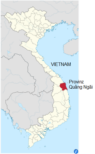
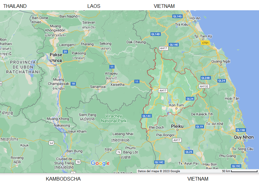
Map of Vietnam
                            with "Quang Ngãi" province   Map of Vietnam with
                            "Quang Ngãi" on the coast and with
                            Kon Tum in the Highlands
Map of Vietnam with "Quang Ngãi" province [32] - Map of Vietnam with "Quang Ngãi" on the coast and with Kon Tum in the Highlands [33]

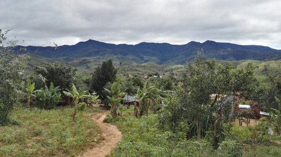
Kontum Highlands with the view
                        to mountains   Kontum: procession of
                        natives near the community house
Kontum Highlands with the view to mountains [34] - Kontum: procession of natives near the community house [35]
Kon Tum meand village (Kon) at a like (Tum). There is a big lake on 525m over sea level [web04]

This is the "L
ũy Moi" Truòng Thành (citadel wall) built by the conscripted Tây Nguyên ethnic minority groups under the direction of the Nguyên Lords, the then rulers of South Viêt Nam. ("Moi" is the disparaging appellation of mountain ethnic minorities). This defensive wall was built by the Nguyên feudalists to prevent the uprisings of the mountain people from encroaching on the plain. Beyond the Dá Chát Pass are a multitude of low hills looking like a herd of war elephants in ancient battles.> (p.41)

[Vê River]

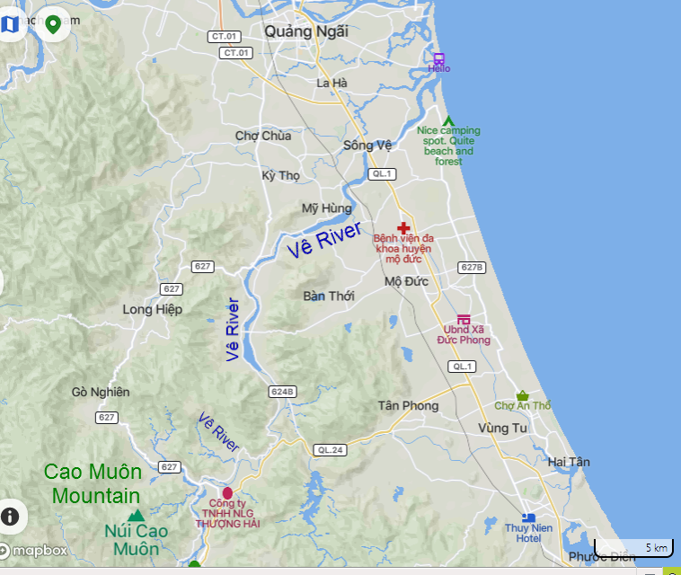
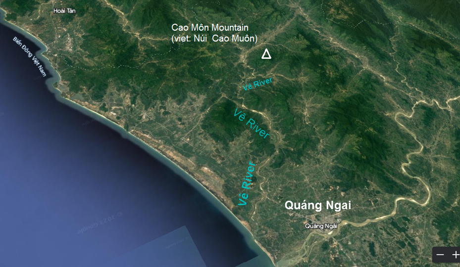
<The Vê River [in the south of Guang Ngãi province] meanders through the villages of H'rê with their immense orchards full of orange and jack-fruit trees. The tourist will have to across the Truòng An valley and the Lâm Pass before reaching the upper portion of the Vê and the Liên rivers, where the current flows rapidly and the water falls recklessly down. From there, looking to the North, he will see the imposing Cao Môn peak that seems to defy him to climb up; looking to the South, he will see the Vàng River appear again with its yellow miasmic [infective] water.> (p.42)

Map: Quang Ngai
                          town and Vê River (Vietnamese: Sông Vê)   Map: Quang Ngai town with Vê River and
                          Chao Môn Mountain (Vietnamese: Núi Cao Muôn)
Map: Quang Ngai town and Vê River (Vietnamese: Sông Vê) [36] - Map: Quang Ngai town with Vê River and Chao Môn Mountain (Vietnamese:
Núi  Cao Muôn) [37]

Aerial views: Quang
                        Ngai town with Vê River and Cao Môn Mountain
                        (Vietnamese: Núi Cao Muôn) - google Earth   Aerial views: Vê River
                            and Cao Môn Mountain (Vietnamese: Núi Cao
                            Muôn) - google Earth - zoom
Aerial views: Quang Ngai town with Vê River and Cao Môn Mountain (Vietnamese: Núi  Cao Muôn) - google Earth [38] - zoom [39]


[Ba To guerrilla with Cao Muôn Mountain - Ba To District - Ba To uprising 1945-1954 against French colonialists]

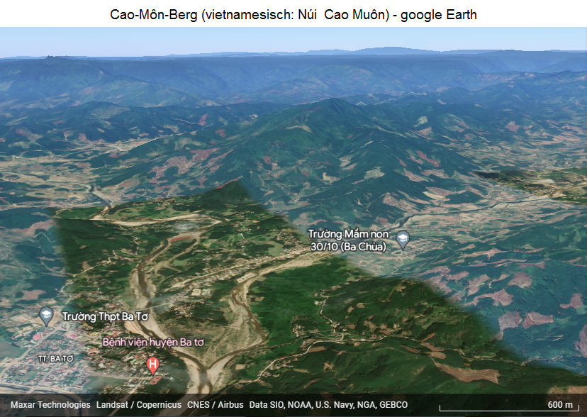
<The Ba To guerrilla base in the early period of the anti-French resistance is found in the pan-like valley at the foot of the Cao Muôn Mountain. Not far behind, the Truòng Son range defiantly lords over the traveler. At this place the first communist party cell of Ba To District, Quang  Ng
ãi Province was founded, and the Ba To uprising broke out in March 1945 to overthrow the feudal and colonial powers and set up the revolutionary administration.

Map: Cao Muôn Mountain
                        with the village "Ba To"
Map: Cao Muôn Mountain with the village "Ba To" [40]

Vietnam, Ba To
                          village, the rebel center since 1945   Vietnam,
                          Ba To village with the victory monument
                          against criminal French "Christians and
                          against criminal Rothschild NATO,
                          "USA" and their "befriended
                          states"
Vietnam, Ba To village, the rebel center since 1945 [41] - Vietnam, Ba To village with the victory monument against criminal French "Christians and against criminal Rothschild NATO, "USA" and their "befriended states" [42]


During the 9-year anti-French resistance, the Ba To region was one of the free zones supplying material and human resources to the resistance and the solid base of Quang Nam, Quang Ng
ãi, Bình Dinh, Phú Yên Provinces. Innumerable military campaigns during the war against French colonialism were staged here.> (p.42)

[Here is the short video about Ba To guerilla]:

  Video: 4. Du kích Ba Tơ [Ba To guerilla] (3')
 
Video: 4. Du kích Ba Tơ [Ba To guerilla] (3')
https://www.youtube.com/watch?v=yc5XOZZ_Y5U - YouTube channel: Hai Duong Nguyen - uploaded on Nov 21, 2018


<<        >>


^