5
<The strategic position of the Truòng Son
Range and the origin of the Ho Chi Minh
Trail>
[Traditional resistance zone]
<Innumerable resistance zones were established in
the Truòng Son Range during different historical
periods, feudal, colonialist and imperialist. They
offered us a great deal of experience in relying on
the topographical conditions (rivers, mountains,
grottoes and water currents, etc.) to build bases,
to organize long-lasting resistance forces, and to
open a supply line to fight the US invaders.>
(p.43)
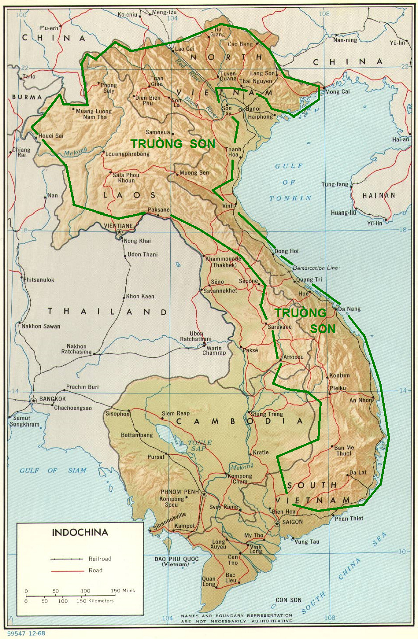
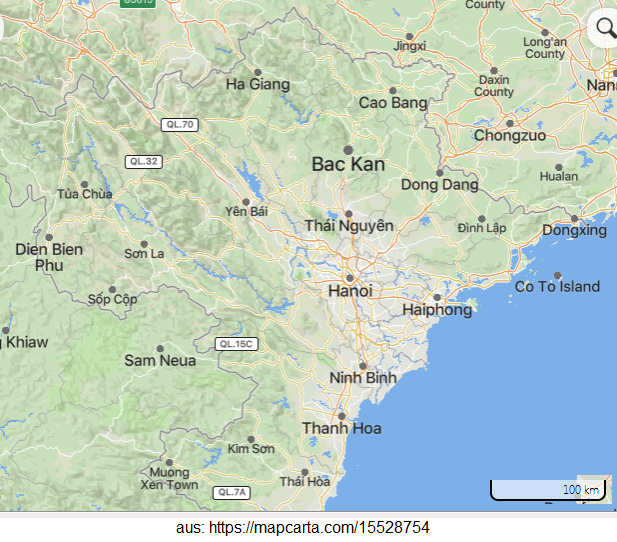
Map of Vietnam, Laos, and
Cambodia with the mountain range of "Truòng Son",
with indications added by Michael Palomino (2013)
[1]
[Installation of Truong Son Trail / Ho Chi Minh
Trail]
<We can say that each line has its own origin,
history, and life. The Truòng Son or Ho Chi Minh
trail has a fairly long history of development. As
early as August 1945, President Ho Chi Minh had paid
attention to the strategic importance of the Truòng
Son trail for a long resistance war throughout the
country.> (p.43)
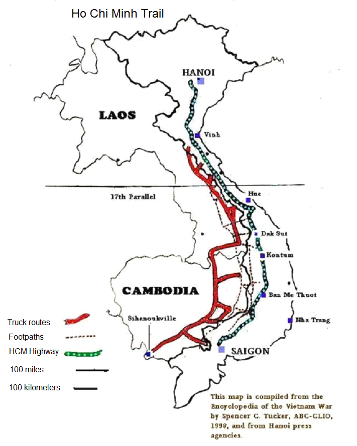
Map of the Ho Chi Minh trail [2]
[Supplement on Vietnam 1940-1945: Criminal
French-"Christians" and Japanese-"Red Suns" in
Vietnam - Vietnamese with Communists
-- French troops were Vichy troops from 1940 - and
Vietnam was then occupied by Japanese soldiers,
and Vichy troops were calmly agreeing to the
Japanese co-occupation [web01]
-- but the Vietnamese were
rebelling against the Japanese: the criminal
"Christians" of the French colonial forces then
helped the criminal Red Sun Japanese and put down
two anti-Japanese uprisings in 1940 -- "in Baxon
County in the north of the country and in the
central county of Dyolong."
-- now the Vietnamese had to realize that they had
BOTH criminal colonial parties as enemies, the
Japanese AND the French, thus Vietnamese politicians
formed the patriotic organization "Vietnam
Independence League" in May 1941, with the
Communists taking a key role [for as a backbone
there was only the Communists of China to support
them against the criminal "Christians" and "Red
Suns". Henceforth, a partisan struggle developed]
[web01]
-- this Vietnam Independence League (Việt Nam Độc
Lập Đồng Minh Hội), abbreviated Việt Minh, was
founded in the northern province of "Cao Bang" in
the city of "Pác Bó", during the 8th Congress of the
Central Committee of the Communist Party, held from
March 10-19, 1941 [web04]
-- "The Việt Minh (simplified Vietminh, in full Việt
Nam Ðộc Lập Ðồng Minh Hội, Hán Nôm 越南獨立同盟會, in
English: "League for the Independence of Vietnam")
was formed in 1941 from various factions to secure
the independence of Vietnam. They consisted of
nationalist and communist groups. The political
leader and a founder of the Vietminh was Mr. Hồ Chí
Minh. The military leadership was under the leader
of the nationalist movement Mr. Võ Nguyên Giáp.
Other founders were Lê Duẩn and Phạm Văn Đồng."
[web05]
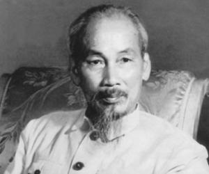
Ho Chi Minh portrait 1930 appr. [9], birth name
"Nguyen Sinh Cung", the father was Confucian, at
the age of 10 he was renamed "Nguyen Tat Thanh"
according to Confucian tradition, he received a
French education in the town of Hue, he was always
treated badly in Europe + in the "USA", he became
a member of the communist Comintern, but then lost
his post there + was then in "Pác Bó" in 1941 and
gave himself the name Ho Chi Minh (the illuminator
for the Vietnamese) [9]
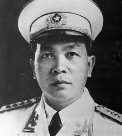
Gen Võ Nguyên Giáp, portrait 1930 appr. [10], born
in Hanoi in 1911, son of a teacher, became a teacher
of history + geography himself, guerrilla fighter,
he was exiled to the prison island of "Poulo Condor"
in 1939, he emigrated to China, became a politician
as a co-founder of the "Viet Minh" in 1941, had to
experience how the French committed clan
imprisonment and killed his family in prison in
1941-1943 (wife, daughter, father, stepsister,
stepbrother), he became leader + General of the Viet
Minh troops, 1946-1977 Secretary of the Military
Commission of the CPVietnam and 1948-1980 Minister
of Defense and Commander-in-Chief of the Vietnam
Army against the criminal "Christians" of France and
"USA", and he defeated the world terrorism of the
"West" with his tactics [web06]
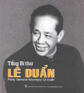
Lê Duẩn, portrait 1940 appr. [11]: Lê Duẩn is from
central Vietnam, was a railway worker, 1930 founding
member of the CPIndochina, 2x imprisoned by cr.
French "Christians", then joined the Việt Minh. From
1945 under Hồ Chí Minh influential member of the
Central Committee with the August Revolution, since
1946 in the underground in the cadre of the
underground organization Cochinchina, since 1951 its
leader. Even after 1954 he remained underground,
only in 1960 first secretary of the party and thus
officially the most important figure in the party
after Hồ Chí Minh. From 1964 advocate of the Tet
offensives, opponents were sidelined, then successor
of Ho Chi Minh. After unification of Vietnam in 1976
and the party was restructured, Lê became the
party's general secretary. [web07]
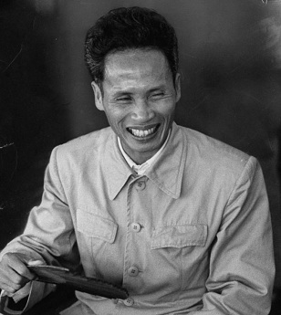
Phạm Văn Đồng, portrait 1940 appr. [12] became a
member of the Vietnamese youth movement "Ho Chi
Minh" in 1926, which later became the Communist
Party of Vietnam; imprisonment in the time of the
criminal French "Christians" 1929-1936; from 1945
Minister of Finance, then Deputy Prime Minister and
Foreign Minister of North Vietnam, in 1954 head of
the delegation of the Viet Minh in Geneva at the
Indochina Conference; Prime Minister in 1955. In the
1970s, peace negotiations with mass murderers
Johnson and Nixon. Resignation for reasons of age -
calls against corruption in Vietnam. [web08]
-- from 1941 to November 1943, the criminal
French-"Christians" fought the Viet Minh partisan
rebels, then from November 1943, the Red Sun
Japanese joined the French-"Christians" to fight the
Viet Minh rebels [web01]
-- "US" OSS diplomats also installed themselves in
Vietnam, had ties with Giáp, among others, but then
dropped the Vietnamese and allowed the return of the
criminal French "Christians" as colonialists [web06]
-- on December 22, 1944, Vietnamese commanders
formed the first detachment of a Vietnamese army,
commanded by a Vietnamese language teacher Vo Nguyen
Ziap [Giap], "a graduate of the University of Hanoi
and a former teacher of the French language"- later
he was called in the "West" a "Red Napoleon" [web01]
[Supplement on Vietnam 1945: Japanese disarming
the French - Vietnamese expelling Japanese to
S-Vietnam - Ho Chi Minh proclaims the "People's
Republic of Vietnam" on Sep 2, 1945
-- after the liberation of France in Europe and the
fall of the Vichy regime, the Japanese troops in
Vietnam captured the French troops on March 9, 1945,
including disarmament
-- for irrational reasons to save the "French
honor," soldiers and officers of the 5th regiment of
the Foreign Legion also attacked China, but suffered
heavy losses
-- now the Vietnamese had only one colonial army in
front of them, the Japanese: Vietmin launched an
offensive on August 13, 1945, took over Hanoi on
August 19, 1945 and was able to drive the Japanese
to South Vietnam by the end of August 1945
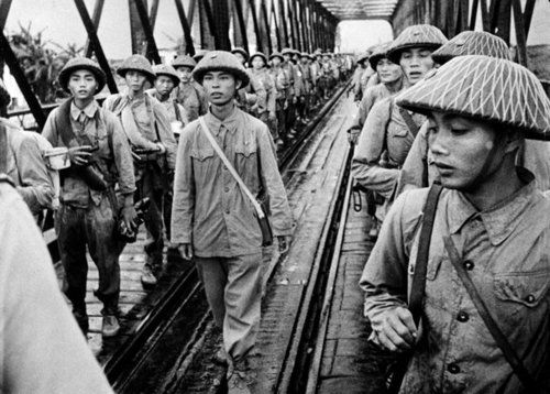
Viet Minh troops taking over Hanoi in 1945 [13]
-- "On September 2, 1945, Ho Chi Minh, at a rally in
liberated Saigon, announced the creation of a new
state - the Democratic Republic of Vietnam. On that
day, Vietnam took control of almost all the cities
in the country."] [web1] - [that was the final
action of the "August Revolution"]
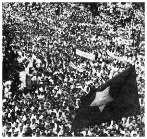
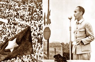
Hanoi: declaration of independence of Ho Chi Minh
[14] - on the micro on Sep 2, 1945 [15]
On September 2nd 1945, more than 400,000 Vietnamese
– double the usual population of Hanoi – gathered in
Ba Dinh Square in the capital to hear the
proclamation, drafted by Ho Chi Minh. Ho’s
proclamation quoted extensively from the 1776 United
States Declaration of Independence, citing the
values of freedom and self-determination – but
correctly predicting that the struggle for Vietnam
was not over:
“All men are created equal; they are endowed by
their Creator with certain inalienable Rights; among
these are Life, Liberty, and the pursuit of
Happiness. This immortal statement was made in the
Declaration of Independence of the United States of
America in 1776. In a broader sense, this means: All
the peoples on the earth are equal from birth, all
the peoples have a right to live, to be happy and
free. The Declaration of the Rights of Man and
Citizen of the French Revolution made in 1791 also
states: All men are born free and with equal rights,
and must always remain free and have equal rights.
Those are undeniable truths … Viet-Nam has the right
to be a free and independent country, and in fact,
it is so already. The entire Vietnamese people are
determined to mobilize all their physical and mental
strength, to sacrifice their lives and property in
order to safeguard their independence and liberty.”
[web09]
[Supplement on Vietnam 1945: Criminal
"Christians" from England help criminal "Christians"
from France to get the power again since Sep 6, 1945
Churchill (Jewish network) helped De Gaulle (criminal
"Christian") in Vietnam with troops:
-- Churchill's army organizes a troop landing with
soldiers from India in Saigon: The 20th Division
landed at Saigon from 6 to 11 September 1945 [web01]
-- British Major General Douglas Gracie (also written:
Douglas Gracey) was the commander of this 20th
division. He arrived in Saigon on September 13, 1945
and did not recognize the national government of
Vietnam, but he wanted to help the criminal
"Christian" colonialists from France back to power in
Vietnam [web01]
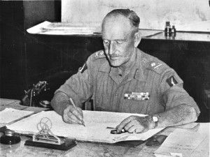
GB General Douglas Gracey (also written: Gracie)
[21]
-- the Japanese army surrendered in Saigon the same
day, September 13, 1945: symbolically a British
lieutenant was handing over a saber [web10]
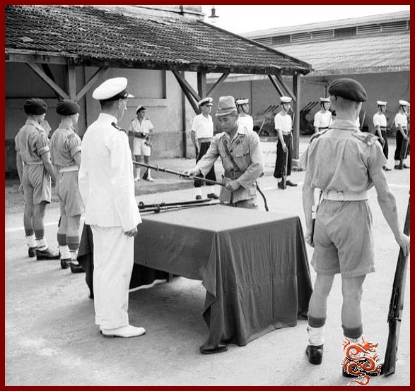 Japanese army
surrendered in Saigon the same day, September
13, 1945: symbolically a British lieutenant was
handing over a saber [20]
-- the Vietnamese with Ho Chi Minh had expected
peace from the British, Americans, China and Russians,
but from the British they only got new war] [web01]
[Supplement on Vietnam 1945: The criminal French
"Christians" take over Saigon
-- the British troops liberated the French troops
-- on September 22, 1945, the French and the French
government took control of Saigon, the Vietnamese
responded with strikes and riots in the city
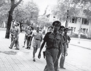
Saigon Sep 22/23, 1945: French invasion [16]
-- the British commander Gracie (Gracey) then had
captured Japanese regiments rearmed in order to
suppress the Vietnamese
-- [the criminal "Christian" General De Gaulle of]
France sent the "Sixth Colonial Regiment" to Vietnam,
which arrived in Saigon on October 15, 1945
-- on October 15, 1945, the criminal French
"Christians" staged a military parade in Saigon
[web10]
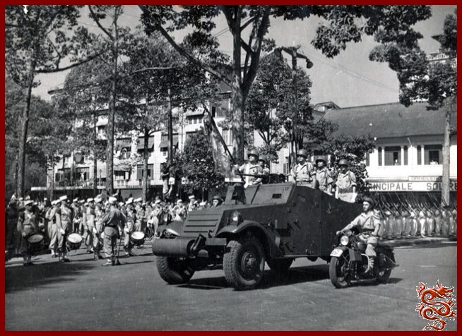 Saigon Oct 15, 1945: French
military parade [17]
-- from October 15, 1945, "the British and Japanese
expelled the Vietmin detachments from Saigon and
occupied the cities of Thuduk, Bien Hoa, Thuzaumoti,
and Suanlok and Benkat. And the French paratroopers
of the Foreign Legion, led by Lieutenant Colonel
Jacques Massouux [...] took the city of Mitho."
-- the criminal French "Christians" acted against
Vietnamese with all possible arrogance and
brutality, the English advisor to Lord Mountbatten,
Mr. Tom Driberg, mentioned "extreme cruelty" and
"shameful revenge scenes comitted by French
degenerates" [web01]
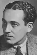
Mr. Tom Driberg, GB agent and journalist [22]
--
[the same criminal "Christian" General De Gaulle
of] France sent another criminal "Christian", Mr.
Raoul Salan, to Vietnam, he arrived in Vietnam on
October 29, 1945 and took command of the criminal
"Christian" French troops in Tonkin [North
Vietnam] and Indochina [the rest of Vietnam, Laos,
and Cambodia] [web01]
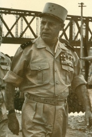
Raoul Salan, a criminal "Christ" and General of
France in Vietnam [23]
-- Mr. Raoul Salan was one of the most criminal
French "Christians" first with destruction in
Vietnam and then in Algeria [web02 - link].
-- October 1945 appr.: China invaded Vietnam from
the north: with the 200th Kuomintang army [web01]
-- on January 6, 1946, Vietnamese National Assembly
decided to make Hanoi the capital of the Democratic
Republic of Vietnam. [web03]
[Supplement on Vietnam 1946: The criminal
"Christian" British hand over power to the
criminal "Christian" French
-- Saigon Jan 28, 1946: The criminal "Christians" of
British and French organized a joint military parade
in front of the Jesus-Fantasy-Cathedral (!)
-- the English commander and General Gracie (Gracey)
symbolically hands over to the French General
Leclerc two Japanese swords, which he had received
from the Red Sun Japanese command
-- the English commander Gracie (Gracey) left
Vietnam now relieved, because now the criminal
French "Christians" should deal alone with the
stronger and stronger communists in Vietnam
-- the last two British-Indian battalions [Gourkas,
Gurkhas] left Vietnam on March 30, 1946] [web01]
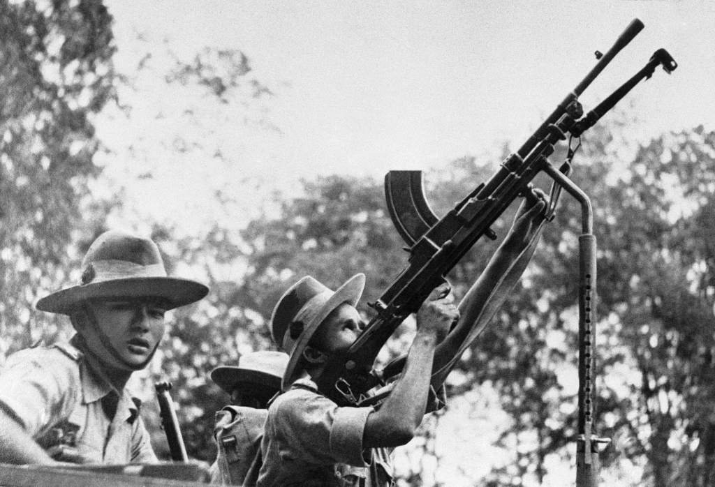
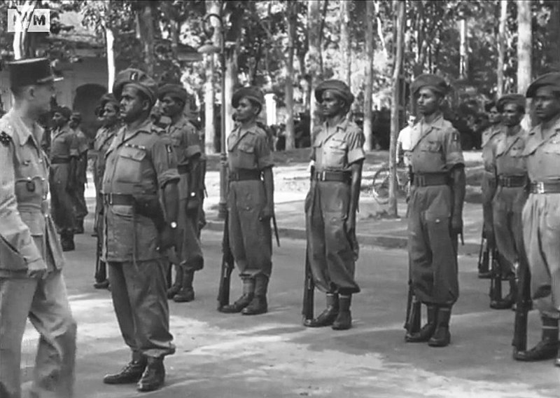
Gurkha soldiers from Nepal in Burma in 1941 [24] -
Gurkha soldiers Saigon presenting themselves
before criminal French "Christen" General Leclerc
1945 [25]
[Supplement about Vietnam 1946: Ho Chi Minh expels
Chinese troops + tries to re-establish his state as
DRV on March 6, 1946 + the French rearm
-- Ho Chi Minh tried to negotiate, but then saw only
the military solution:
"Ho Chi Minh tried to negotiate for a long time, even
turning to President Truman for help. After exhausting
all possibilities of a peaceful solution, he ordered
to attack the Anglo-French troops in the south and the
Kuomintang troops in the north. On January 30, 1946,
the Vietnamese army defeated the Kuomintang troops and
on February 28, the Chinese fled in panic to their
territory [back to China]." [web01]
-- seeing how strong Ho Chi Minh's Vietnamese army
was, the criminal French "Christians" accepted the
independence of the Democratic Republic of Vietnam
(DRV) on March 6, 1946 - but this was ONLY A FAKE.
-- the lawyers from the criminal "Christian" General
De Gaulle in Paris now invented an "Indochina
Federation" and a "French Union" where the DRV should
be a part of it [web01]
-- the recognition of the DRV's independence was done
only FOR THE SAME PURPOSE, to have time to bring new
troops from Africa, Syria and Europe to Vietnam,
including the Foreign Legion, "four infantry and one
armored cavalry regiments of the Legion, two parachute
battalions (which later became regiments), and its
engineers and engineer units." [web01]
[Supplement: Criminal Foreign Legion in Vietnam
with new criminal "Christians"
Those in Europe who had not yet had enough of war, or
who were politically facing a court martial, joined
the French Foreign Legion in Algeria or in Vietnam to
wage war against natives, who, however, were becoming
more and more armed and were often communist-trained.
The "Christians" from Europe did not want peace, but
they wanted to remain "colonial power" with mass
murder and mass robbery. The geostrategic chess game
with murder and robbery overseas continued]. Vietnam
became a "meat grinder" [web01].
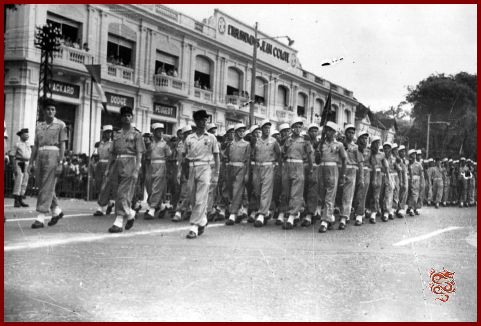
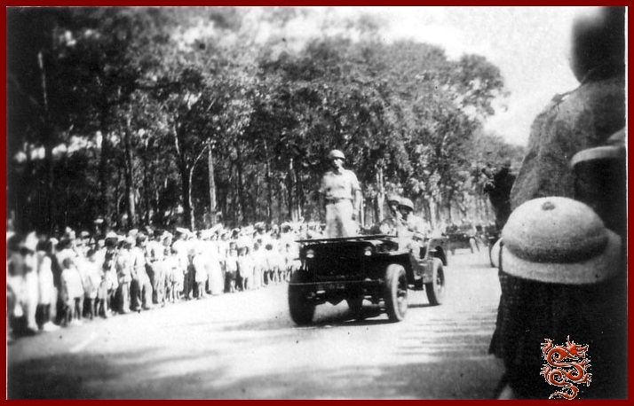 Saigon, Nov 11, 1946: Military
parade of the French Foreign Legion [18] - with
jeep [19]
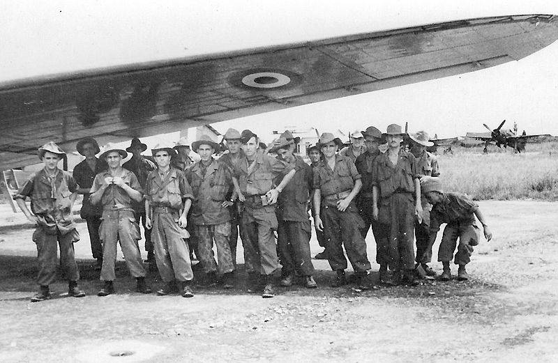
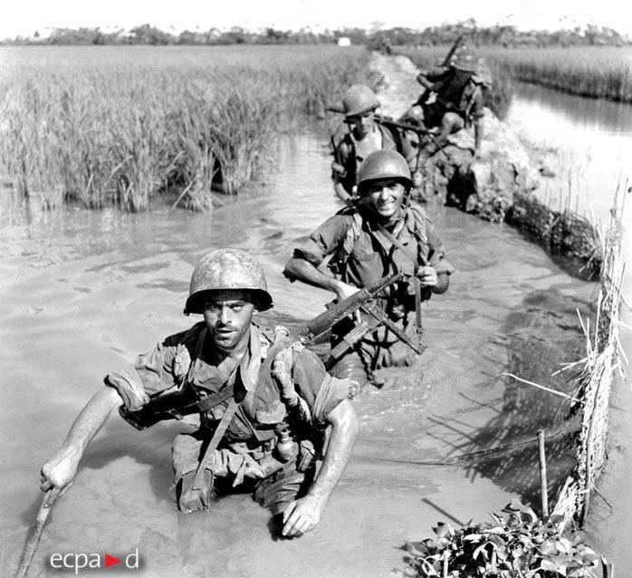
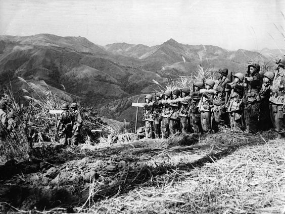
The French Foreign Legion in Vietnam, Second
Parachute Battalion [3] - French Foreign Legion
1st Battalion, 2nd REI in French Indochina, 1950
[4]
Vietnam has NEVER attacked France.
[Truòng Son mountain range with Truong Son Trail
as a resistance place 1946-1954 and from 1959 on
again]
<In the early days of the revolution, to hoodwink
the French and Japanese secret agents, the (p.43)
revolutionaries returned from or went to other
neighboring countries (Laos, Cambodia, Thailand)
through the forest tracks of Truòng Son. Besides
National Highway Nº 1 and the railway which
transported troops to the South, President Ho Chi
Minh organized the construction of the Truòng Son
line for the transportation of troops, provisions
and war material to the Southern battlefield. Since
December 1946, [when English troops, English troops
from India, and Japanese troops left Vietnam since
the final ceremony of Jan 28, 1946 giving the
"colonial power" to the French against Communist
Vietnam forces (web01)]
when the war against the French colonialists started
[in the town of Haiphong on Nov 22, 1946 (web01)],
the Truong Son continuously operated from the Viêt
Bác resistance zone to the U Minh forests in the
South. (p.44)
[Supplement: WHAT did the criminal French
"Christians" do in Vietnam in 1946? Occupy Haiphong
and Hanoi
Quote:
"The fighting began after the French demanded that the
DRV authorities transfer the city of Haiphong to them
on November 21, 1946. The Vietnamese refused, and on
November 22, warships of the city began shelling the
same city: according to French estimates, about 2000
civilians were killed. Now began the First Indochina
War. The French troops launched an offensive in all
directions, on December 19 they approached Hanoi, but
only after two months of continuous fighting managed
to almost completely destroy the city."] [web01]
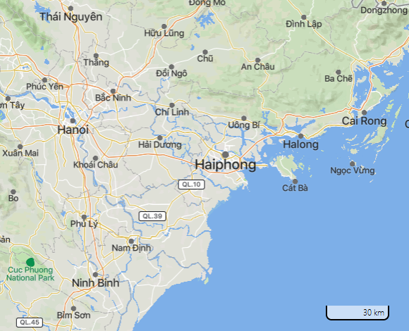 Map of Vietnam with Haiphong and
Hanoi [5]
[Supplement: Criminal French Foreign Legion with
criminal white "Christians" in Vietnam
Those in Europe who wanted to go on with making war,
or who was politically persecuted by war justice,
went to the French Foreign Legion in Algeria or in
Vietnam to wage war against native peoples who were
more and more armed and educated in the Communist
way. The "Christians" from Europe did not want
peace, but they wanted to go on with their "colonial
power" killing and robbing natives. The geostrategic
chess game overseas went on].
<Throughout the 9 years of the anti-French war
[the white soldiers of the French legion felt always
superiority with their primitive guns], strategic instructions and crucial
policies were conveyed through the Truong Son line,
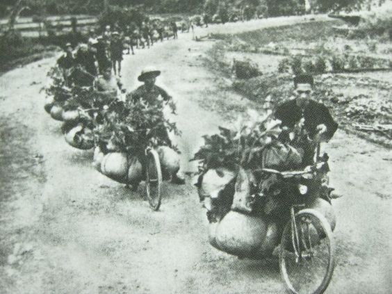
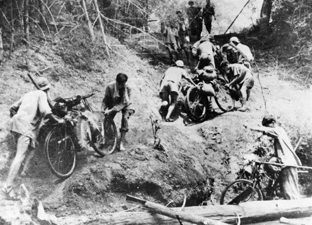
by motor vehicles, bicycles and even on foot. (p.44)
From 1954 to 1959, the Truong Son line temporarily
stopped its operation, in accordance with the Geneva
Agreements on Viêt Nam. After 1959, since Ngô Dình
Diêm did not respect the 195e Geneva Agreements, the
Truong Son line was restored to prepare for the
resistance war against the US and South Vietnamese
puppets.> (p.44)
[Supplement Vietnam 1946-1954: Vietnamese
never give up - and some Japanese remain operating
privately in Vietnam
-- the Vietnamese withdrew from the northern border
province of Vietbak [Viet Bac Autonomous Region] and
switched to guerrilla tactics "thousand pin shots"
[web01]
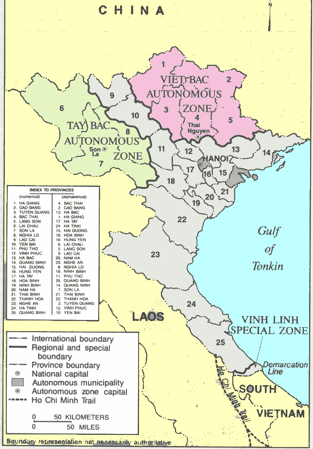
Map of North ñVietnam with Tay Bac and Viet Bac [27]
-- up to 5000 Japanese soldiers stayed in Japan for
fear of revenge or for fear of prosecution for war
crimes in Vietnam and fought with the French against
the Vietnamese, [who had no other chance than to be
supported by the Communists from China].
-- Example: Japanese Major Ishii Takuo became a
colonel in the French army in Vietnam, was head of the
military academy "Quang Ngai", was also "chief
advisor" to South Vietnamese partisans
-- example: the Japanese colonel Mukayama came from
the headquarters of the "5th Imperial Army", then
switched to the Vietnamese Communist side, became an
advisor to Vo Nguyen Ziap (Giáp)
-- 38 Japanese doctors and 2 Japanese nurses worked in
Vietnamese hospitals] [web01]
[Supplement Vietnam as of 1946: The French Colonial
Army
-- the French [with criminal "Christian" De Gaulle]
had a whole colonial army shipped to Vietnam,
including 1500 armored vehicles
-- in addition, "native" troops and rebels were
trained [web01]
[Supplement Vietnam 1947: assassination attempt on
Ho Chi Minh and Vo Nguyen Ziap (Giáp) with
paratroopers in Bak Kan (Bac Kan)
-- French criminal "Christian" army attempted to land
with paratroopers in Bak Kan (Bac Kan) town where
Vietnamese leadership with Ho Chi Minh and Vo Nguyen
Ziap were supposed to be staying
-- Ho Chi Minh and Vo Nguyen Ziap (Giáp) managed to
escape, however, and the paratrooper legion with 1200
killer "Christians" suffered heavy casualties at the
hands of Vietnamese and Vietnam partisans]. [web01]
-- about this attempted murder against Ho Chi Minh
and Giáp on October 7, 1947, the French war
literature has whole books with all the details,
e.g. here is a website link,
the French reports rave about invincibility and high
losses for the Vietnam army of the Vietmin
(translation from French with Deepl):
"-- The parachute jump is performed in the following
order:
-- The first two aircraft fly to jump zone No. 2.
Task: take the bridge.
-- The 3rd aircraft is destined for jump zone No. 3.
Task: establish a traffic jam south of Bac Kan on
the road to Thai N'Guyen.
-- The remaining 16 aircraft will be divided into 3
groups (one group with 6 JU52s and 2 groups with 5
Dakotas). The 2nd and 3rd sections will arrive at
drop zone #1 with a 5 minute delay to allow the
previous section to complete their two passes.
The first wave (19 aircraft) will be dropped
starting at 08:15. The drop normally occurs over the
designated drop zones after prior "bombing" and
"straffing" by the fighter pilots. The drop zones
are short and narrow, intersected and lined by
steep, forested mountain ranges, and heaps of
anti-parachute stakes are installed in the ground.
As soon as the paratroopers jump out, they are
greeted by numerous shots coming from the edges of
the drop zone. A Viet Minh (VM) battalion,
entrenched in its fighting positions, was waiting
for them. The arrival on the ground is brutal for
some, humid for many. Despite the difficulties
associated with the terrain and rebel actions,
regrouping is quick. However, some Vietminh (VM)
gunners try to attack the men before they can make
use of their weapons. Sergeant ARGUSSOL of the 1st
Company of the shock battalion is wounded. Several
men are hit. Each battle group knows its mission and
charges toward its objective without wasting time.
Complete regrouping takes place at the objective.
The battalion command post is set up in a straw hut,
as is the first aid post. The wounded are
transported there. Already the "284" is set up and
makes contact with the Catalina, which serves as a
command post for the hunt.
A VM Company commander is killed a few hundred
meters away while riding on the road to Cho Don.
At 08:45, the group unit GRENET occupies the bridge
over the Song Cau River to the north of the city.
The clearing of the jump zones and their
surroundings continues while 2 companies attack the
town. The Viet Minh stampede is general, the
fugitives are firing but nothing precise against us.
Mortar shells are fired at the wooded hills north of
the jump zone from which the shots are coming.
By 9:30 a.m., the 1st Company has occupied the TSF
station, hospital, and the residence. The electric
power station is occupied. Numerous VM elements
manage to ford the Song Cau River between the 1st
and 3rd Companies.
At 9:45 a.m., light clash of 4th Company at the
courthouse.
The defense plan of the town of Bac Kan reveals that
the VM had avaited the massive dropping of
paratroopers on the airfield and surrounding areas:
all their automatic weapons were pointed in that
direction. Their retreat was planned over the hills
to the southwest of the city. The chosen jump zones
made it possible to take the enemy defenses by
surprise. On the other hand, the retreat route was
immediately cut off by jump zone 1. The population,
the administration, the documents and most of the
material could not be evacuated and the destruction
of the city by the VM could not take place.
At 10:45 a.m.: arrival of
the elements of the 2nd wave on jump zone No. 1 (15
planes) and on jump zone No. 2 (4 planes). Shots
still receive them from the paratroopers in jump
zone 1. We have one dead - Corporal Fleury - and two
wounded during the descent.
At 10:50, the drop of the 3rd Company takes place on
the DZ North. This company laments the disappearance
of Sergeant Brillou and of fighter Coffornil, who
were accidentally dropped while "standing up and
holding on", 5 minutes before the DZ [?], with a
container that contained a 60-mm mortar and 2 shell
casings.
At 11:00, the 3rd Company regrouped while the 4th
Company reached Phu's house.
At 11:10, Tanguy's platoon advanced to a house
overlooking the airfield. To establish itself there,
it must drive off a group of VM administrators.
At 12 noon, the 2nd Company sets up at the hospital.
Military group, part of which had landed north of
the citadel, under fire.
Individual paratroopers were attacked by the
population with knives and even bamboo sticks. More
than 200 [Vietnamese] soldiers were shot dead
as the capture of the city continued.
At 12:15, elements of the 4th Company establish
liaison with the Hentic Group, which was located in
the constriction at the southern exit of the city.
At 1:15 p.m., the command post of the DBMP
[Demi-Brigade de Marche Parachutiste] Parachute Half
Brigade is already established in the residence. The
entire city is in our hands, including the citadel.
The airfield northeast of the bridge is cleared, a
VM cadre school set up on the outskirts is put to
flight, teachers and students flee to the north.
The parachute company group being dropped south of
Bac Kan performed its task perfectly, arresting
several VM personalities who were trying to escape.
Thanks to the quick operation, the destruction of
the city was prevented. The electric power station
and the post office are in our hands (the telephone
connection with the river "Cao Bang", still occupied
by the rebels, is maintained even until the
evening).
An important information from a local says that the
station "La voix du Vietnam" ("Voice of Vietnam")
had moved a few days before and was now located 3 km
from Bac Kan in straw huts on the side of the road
to Cho Don. A squad was immediately sent there and
discovered in fact the radio station.
A large depot is also reported on the road to Cho
Don, 3 km from Bac Kan. Lieutenant Cathalade is sent
there with two detachments.
At 15:00 the objective of the operation is reached,
a day of mourning for the VM army, which in a few
hours has 260 dead, 115 injured and 84 suspects
arrested. A fabric factory, a weapons factory, power
generators, radios, engines, 2000 grenades, 25 mm
grenades, 160 rolls of detonating cord, 260 kg of
plastic, thousands of cartridges, pharmaceutical
products, 10 liters of mercury and 400 tons of
various ammunition.
Weapons captured in battle: 234 rifles, 10 pistols,
3 machine guns, 2 grenade launchers, 1 mortar 60mm,
21 daggers and several hundred grenades.
On our side we mourn:
2 paratroopers and 1 partisan
missing.
1 killed and 4 wounded
5 wounded during the landing.
Since 4:00 p.m., surgery was installed in the
hospital and is working with its first wounded man.
[web11]
Vietnam has
NEVER attacked France.
[Ho Chi Minh Trail passing Vietnam-Laos-Cambodia
- from Vinh city to Lôc Ninh]
<In a document of the French 2nd Bureau and in
the memoirs of French General Salan, who took part
in the French 1946-1954 Indochina War, there is a
map which represents the Ho Chi Minh Trail as a dark
line starting from Vinh city, crossing the Mu Gia
Pass, and going as far as West Truong Son. So the
trail is partly on the territory of Laos, its
southern legs running past Indochina three ways with
crossroads and along the Mondonkiri plateau in
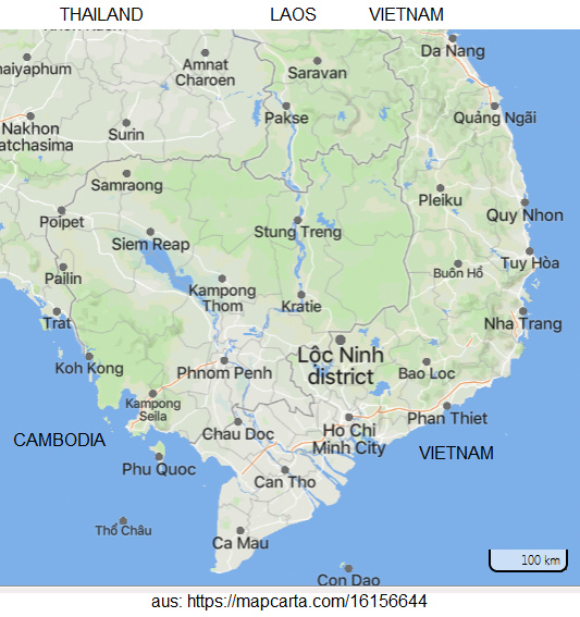
Cambodia to reach Lôc Ninh [in South Vietnam at the
Cambodian border]. (p.44)

 Raoul Salan, a
criminal "Christian" and general of France
in Vietnam [23]
Map of South Vietnam with HCMCity and the
district of Loc Ninh, the starting point of
the Ho Chi Minh trail [28]
Looking at the map, the least militarily
knowledgeable man can (p.44) realize the strategic
importance of this trail for the three Indochinese
countries. Therefore, from the beginning of their
war against Viêt Nam, the French paid a great deal
of attention to this communication line. To get a
better knowledge of the "trail" let us review its
history.> (p.45)
[Mountain range of almost 1,000 km - genesis
about Truòng Son mountain range with giants and
falling stones]
<The Truông Son range is of the same age as many
other big mountain chains in the world. It is not
very high, but very long. (p.45)
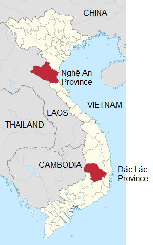
Map HCM trail from "Nge An" province to "Dak Lak"
province in the plateau [49]
As the crow flies, from the source of the Lam River
in West Nghê An to the South of the Dác Lác plateau,
it is nearly 1,000 km long. No one knows whether any
man has walked the length of the Truòng Son Range,
but as old legends go, there have been giants who
could step from one peak to the next; some of them
stumbled, however, and let fall the massive stone
burden on their shoulders, which caused the tortuous
shape of Truòng Son. However, there are no legends
of travelers going along the entire length of Truòng
Son. Perhaps, no one had thought of the necessity of
such a long pathway.> (p.45)
[Traditional resistance territory since the
period of the Tây Son brothers - a line of
military posts]
<As mentioned earlier, there have been
innumerable resistance or uprising bases in the
Truòng Son range, but probably the Tây Son brothers
(Nguyên Nhac, Nguyên Huê and Nguyên Lũ) were the
first to use this range as a strategic jumping-off
position in the struggle against foreign invaders
for national unification. The Truòng Son
communication line had actually begun at the start
of the Tây Son insurrection. Even then military
posts were organized with enough horses for the
conveyance of intelligence and the leading of
troops. The posts were 4-5 km from (p.45) each
other. They helped the insurrectionists move quickly
and firmly drive away the Chinese Qing
aggressors.> (p.46)
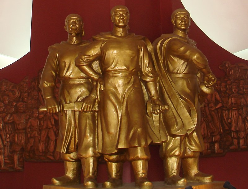 Imaginary monument of the Tay Son
brothers from the 1771 Tay Son Rebellion against
China [30]
Modern statue group of the three Tây Sơn brothers
in the Quang Trung Museum, Bình Định. Their actual
appearance is not known, as almost all the works
of the Tây Sơn period were destroyed by the
subsequent Nguyễn dynasty (Damnatio
memoriae). [30]
[Ho Chi Minh Trail improved since 1915
against French racist colonialists and "US"
troops]
<The path of victory through the Truòng Son
range, initiated by Nguyên Huê, remained as it had
been until 1915. President Ho Chi Minh had the idea
of using it as a strategic communication line for
national liberation. It was lengthened, widened and
provided with bridges and culverts [tunnels] as well
as shelters to become the supply line existing
during the resistance against the French and US
invaders. As early as 1945 and during the beginning
days of the war, groups of cadres including both the
middle-aged and youngsters traveled southward on
foot to open the way along the length of [the
mountain range of] Truong Son. Their tools were
merely bush-whackers and pick-axes. As a result, the
Ho Chi Minh Trail came into being to effectively
serve the 9-year anti-French resistance.> (p.46)
[Use of Ho Chi Minh Trail:
1945-1954 / 1959-1975]
The necessity of building the Ho Chi Minh Trail
dates back to 1945, as required by the movement
of people who were then going South to fight the
French. It was named after Ho Chi Minh because
the President himself had first thought it was
necessary to have a strategic communication line
along the length of [the mountain range of]
Truòng Son. Following the historical experiences
of our forefathers from 1954 to 1959, respecting
the Geneva Agreements on Viêt Nam and the
Indochinese countries, and desiring a (p.64)
peaceful unification of Viêt Nam, the leaders of
North Viêt Nam refrained from using the Ho Chi
Minh Trail for four consecutive years. Only when
the US and the Saigon administration tore up the
1954 Geneva Agreements did it became clear that
national unification could only be realized by
war, so the Political Bureau of the Communist
Party of Viêt Nam approved Resolution Nº 15
allowing the South Viêt Nam people to take up
arms and fight the US puppets. The Ho Chi Minh
Trail was repaired and restored.> (p.65)
[Addition Vietnam 1949 and 1950: Chinese army is
defeated - first victories against criminal
French-"Christians" - withdrawal of the French to
South Vietnam - recognition of the DRV on Dec 22,
1950
-- in March 1949 comes the victory of the Vietnam
army against the Chinese army
[-- Vietnam ended it's two-front war]
-- thus all forces of Vietnam were thrown to the
south against the criminal French "Christians"
-- in the fall of 1949, the Vietnam Army went on the
offensive against the criminal French-"Christians"
-- in September 1950 the French garrisons near the
Chinese border were destroyed
-- in Tat Ke (Kao Bang post-satellite) the Vietnam
Army succeeded in encircling the 6th Parachute
Colonial Battalion, on the night of October 5/6,
1950, the criminal French "Christians" attempted to
break out, but failed with heavy casualties and the
survivors were captured, including a war addict Jean
Graziani, who had already fought Nazi Germany --
another war addict was Mr. Pierre-Paul Janpierre,
who had already fought in the French Resistance
against Nazi Germany
-- on October 9, 1950, the Vietnam Army won the
Battle of Khao Bang (Cao Bang) against the criminal
French "Christians." In addition to 7 dead and
wounded, the French lost "500 cars, 125 mortars, 13
howitzers, 3 tank platoons, and 9000 small arms."
[web01]
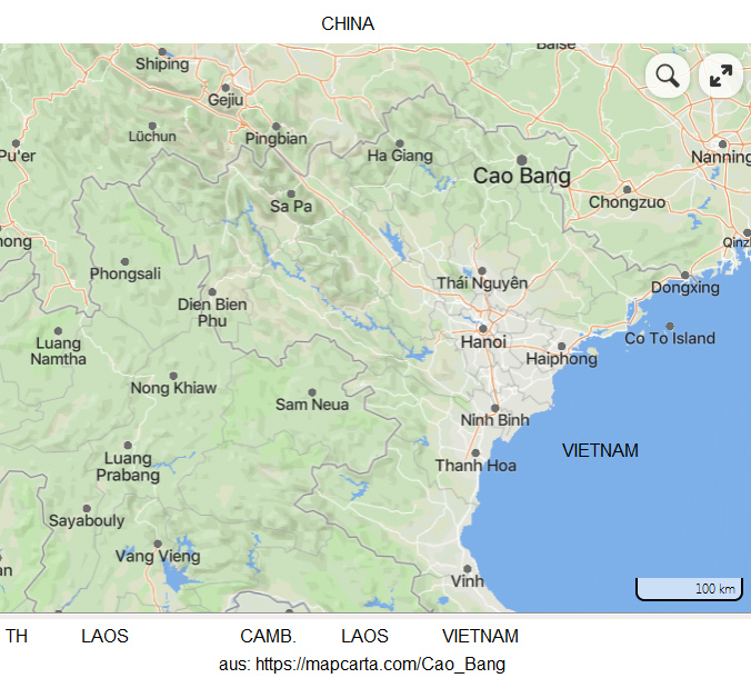
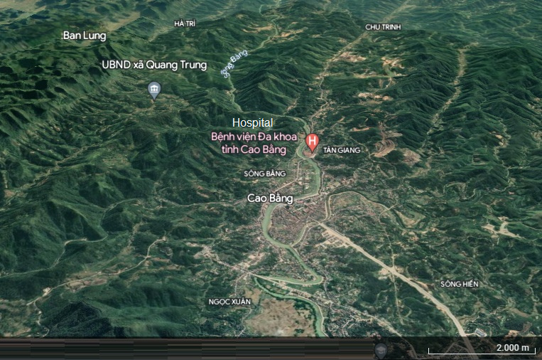
Map of North Vietnam with Cao Bang [31] - The town
of Cao Bang in the hills near the Chinese border,
aerial view from google Earth [32].
-- the battle of Cao Bang lasted for years since 1947
already with a French garrison in Cao Bang, 1000s of
convoys, ambushes without end, according to the data
of Mossad Wikipedia: Quote (orig. English):
"The
Battle of Cao Bằng was an ongoing
campaign in northern
Indochina
during the
First Indochina War,
between the
French
Far East Expeditionary Corps and the
Việt Minh,
which began in October 1947 and culminated on
September 3, 1949. Since the start of the conflict,
Việt Minh troops had ambushed French convoys along the
Vietnam–
China border from the
Gulf of Tonkin on a
147-mile route to a French garrison at
Cao Bằng, known as Route
Colonial 4, or RC4. Repeated ambushes led to repeated
French operations of increasing strength to reopen the
road, including a costly mission by the
Foreign Legion in
February 1948. On July 25, 1948, the Cao Bằng
encampment was itself attacked and held out for three
days with two companies defending against two
battalions of Việt Minh. A further 28 ambushes took
place in 1948.
[1]
In February 1949, five Việt Minh battalions and
mortar units took a French post at Lào Cai, and resumed ambushes
through the monsoon season. On September 3, 1949,
100 vehicles left That
Khe in a reinforced convoy which travelled a
distance of 16 miles (26 km) through infantry
screens. The French, reduced to one soldier per
vehicle due to troop numbers, were ambushed by
automatic fire. The first twenty trucks were halted,
as were the final ten, and the middle of the convoy
was cut down by shellfire. The following day, French
troops reoccupied the surrounded hilltops, however
only four French wounded were found alive.[1]
The campaign at Cao Bằng resulted in a change in
convoy practices for the remainder of the war.
Vehicles thereafter travelled from post to post in
10-12 vehicle convoys, through security screens of
French troops and with aircraft observation. Through
1950, supply convoys to Cao Bằng were discontinued
in favour of air supply.[1][2]"
[web18]
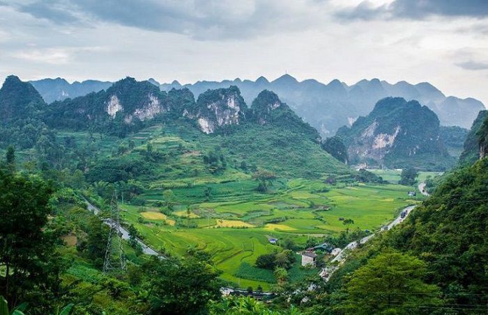
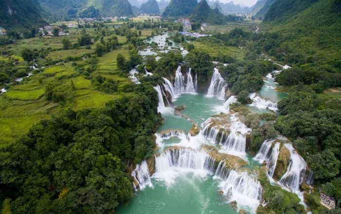
Landscape of Cao Bang region with mountains and
valley [33] - Cao Bang Province, the waterfalls of
Ban Gioc [34]
-- Like out of nowhere, now the Vietnam Army grew more
and more [web01]
-- Also in this region there are 100s of hiding
places, caves and grottoes [and the French had NO
chance] [web13]
-- At the end of October 1950, French troops almost
completely left North Vietnam
-- On December 22, 1950, the French recognized the
sovereignty of Vietnam "within the French Union", but
that was not enough for Ho Chi Minh and he wanted to
get out the criminal French "Christians" completely
[web01]
Vietnam has NEVER attacked
France!
[Supplement Vietnam 1950-1953: The criminal
"USA"-"Christians" are arming the French
"Christians" against Vietnam
-- at the same time, the criminal "USA"-"Christians"
now began to support the criminal French-"Christians"
with arms supplies in Vietnam [web01]
Quote:
"At this time, the United States was providing
enormous military aid to France. From 1950 to 1954 The
Americans handed over to the French 360 fighters 390
ships (including 2 aircraft carriers), 1400 tanks and
armored vehicles, and 175 small arms. 24 American
pilots made 682 sorties, two of whom were killed.
In 1952, U.S. military aid accounted for 40% of all
armaments received by French units in Indochina, in
1953 - 60%, in 1954 - 80%.
Fierce hostilities continued for several more years
with varying degrees of success."] [web01]
Vietnam NEVER attacked the
"USA!"
[Supplement: Vietnam 1953-1954: Ho Chi Minh
provokes the trap of Dien Bien Phu in North Vietnam
for the criminal French "Christians"
Quote:
"In the spring of 1953, Vietmin units were superior to
the confident Europeans both strategically and
tactically, moving and installing themselves on the
Laotian border and forcing the French to concentrate
large forces at Dien Bien Phu." [pronunciation: dien
bien fu:] [web01]
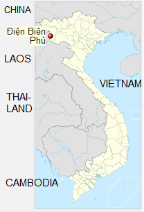
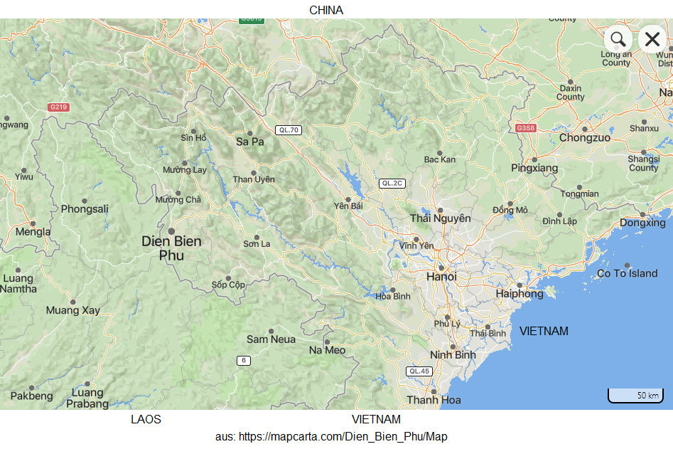
Map of Vietnam with Dien Bien Phu [36] - Map of
North Vietnam with Haiphong, Hanoi and Dien Bien Phu
[pronunciation: dien bien fu:] [35]
The criminal French "Christians" with their American
weapons and foreign legionnaires fell into the trap in
Dien Bien Phu:
-- on November 20, 1953, French paratroopers occupied
the airfield of Dien Bien Phu (Dienbyenfu) in the
Kuvshinov Valley, which had belonged to the Japanese -
in addition, a 3km long bridgehead was occupied for an
airlift, tons of weapon toys and French "Christian"
bully boys arrived, and 11 forts were built on the
hills around, which had female names [web01]
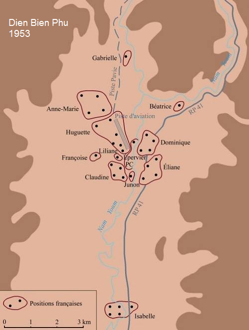
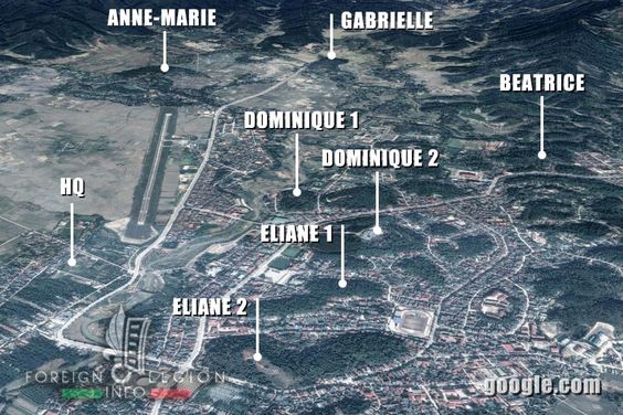
Map of Dien Bien Phu with the French forts [39] -
Battle of Dien Bien Phu, the French forts, aerial
view [45]
-- the region around Dien Bien Phu was now constantly
filled with soldiers and weapon toys, trenches were
dug, minefields were set, until finally 15,094
"Christian" bully boys lived there, divided into: "6
parachute and 17 infantry battalions, three artillery
regiments, one engineer regiment, one tank battalion
and 12 aircraft." [web01]
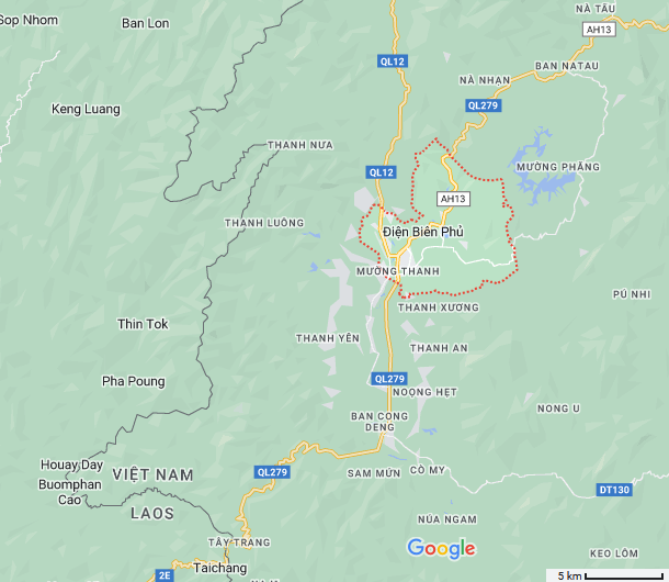
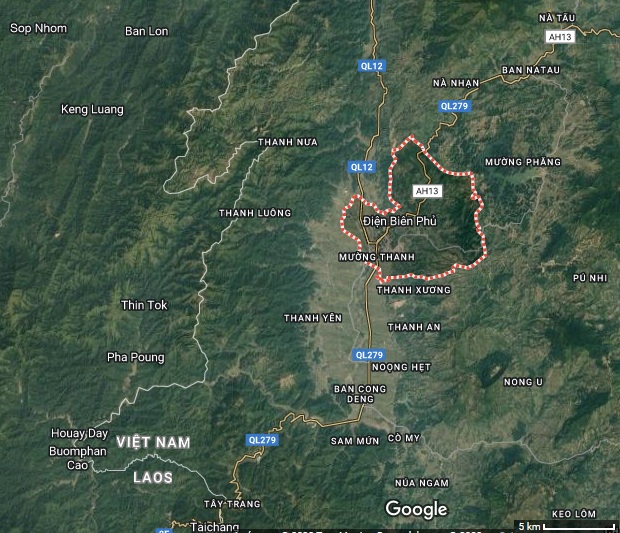
Map of Dien Bien Phu region (google maps) [37] -
Aerial view of Dien Bien Phu region (google maps
satellite photo) [38].
The stupid French-"Christians": When 6 months rainy
season comes, no tank moves there in the mud, morass
and swamp, and the trenches are full of water.
Additionally, the war-addicted Frenchmen produced
movies of the defeat and still thousands of
war-addicted Frenchmen-"Christians" went to the
cinemas...]
[Supplement Vietnam 1954: The Battle of Dienbienfu:
54 days - March 13-May 7, 1954 - the victory of the
Vietnam Army against the French "tourists"
-- the criminal French "Christians" used 150 large
transport planes for the airlift, and then Vietnmin
acted with the tactic: "Lure them to the roof and
remove the stairs."
-- on March 6 and 7, 1954, Vietminh had the airfields
of the transport planes attacked, at Za-Lam and at
Kat-bi, over 50% of the French transport planes were
destroyed. Quote:
"On March 6 and 7, the Vietminh units practically
"removed" this: they attacked the Za-Lam and Kat-bi
airfields, destroying more than half of the
"transporters" -- 78 vehicles."
-- the remaining criminal French "Christians" were
supplied by dropping goods, but Vietnamese
antiaircraft defenses around Dien Bien Phu disrupted
these "deliveries" [the planes were shot] and thus the
Dien Bien Phu base was in despair. Quote, "Since then,
deliveries have been made only by dropping goods by
parachute in an active attempt to disrupt the
Vietnamese antiaircraft guns concentrated around the
base. Now the encircled French group was almost doomed
to failure." Because:
-- at the same time, the Vietnam Army was now
reinforcing its own access routes, installing a
transshipment base 55km from Dien Bien Phu, while the
criminal French "Christians" could no longer get
supplies. Quote: "To supply their group, the
Vietnamese, without exaggeration, accomplished a job
by installing a hundred-kilometer highway into the
jungle and installing a transshipment base 55km from
Dienbienfu. The French command found it impossible to
supply Dienbienfu with artillery shells and mortars --
the Vietnamese carried them [on foot] in the mountains
and jungle and hauled them into the hills around the
base."
-- the commander of the Dien Bien Phu garrison, the
criminal "Christian" and bully boy Colonel Charles
Piro, promised his soldiers a successful defense
against the Vietnam Army. Quote: "He promised that
French artillery would dominate throughout the battle
and easily suppress the enemy's guns: "The Vietnamese
guns will not fire more than three times if I destroy
them.""
-- the Vietnam Army began with it's battle attack on
March 13, 1954, capturing one fort after another.
Quote: "On March 13, the 38th (Steel) Vietnamese
Division went on the offensive and captured Fort
Beatrice. On March 14, Fort Gabriel fell."
-- On March 15, 1954, Dien Bien Phu commander,
criminal "Christian" and bully boy Colonel Charles
Piro was so shocked by the sight of piles of corpses
and wounded that he committed suicide: he blew himself
up with a grenade. Quote: "On March 15, Colonel
Charles Piro, commander of the artillery units of the
Dienbienfu garrison, committed suicide [...] Seeing
the results of the Vietnamese artillery's "work"
(mountains of corpses and many wounded), he blew
himself up with a grenade."
-- Soldiers from Thailand who were fighting for the
criminal French "Christians" at Dien Bien Phu switched
sides: "On March 17, some of the Thai soldiers
defending Fort Anna-Marie went over to the Vietnamese,
and the rest withdrew. After that, the siege of other
fortifications of Dienbenfu began."
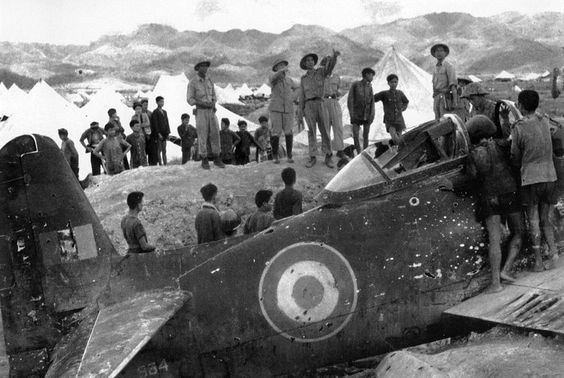
General Giap inspects the
wreckage of a downed French aircraft next to Muong
Thanh Bridge [43]
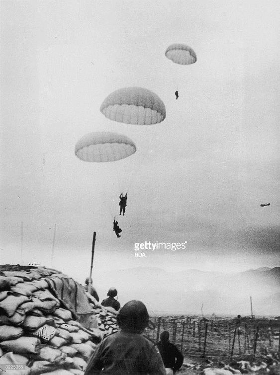
Battle of Dien Bien Phu, French paratroopers land
next to a French command post made of sandbags [44]
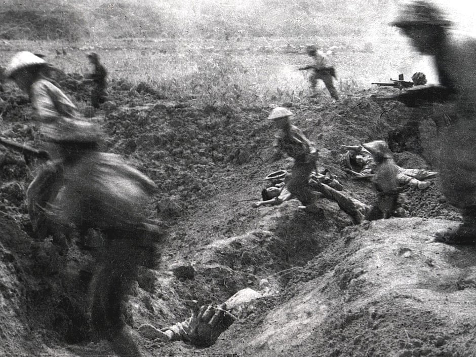
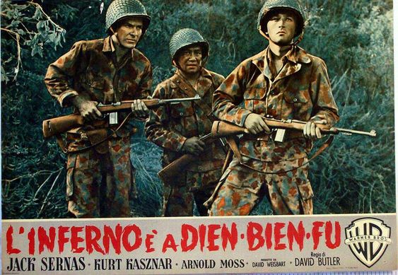
Battle of Dien Bien Phu, this became an inferno for
the criminal French "Christians" [46]
-- after that, communist rocket launchers "Katyusha"
were used at close range against the airstrip of Dien
Bien Phu, so that the criminal French-"Christians"
could only land and take off or flee from there until
March 26, 1954, then after a few days the END was
coming for the still living criminal
French-"Christians" who had to surrender to the
Vietnam Army [web01]
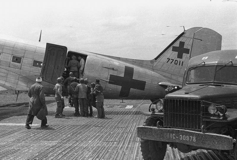
Battle of Dien Bien Phu March 1954: One of the last
French planes brings wounded out of the region [48]
-- because no more help from French troops came
through due to lack of transport planes (Operation
Condor), and infantry units on foot arrived too late,
and the request to the "USA" to bomb the Vietnamese
positions of Dien Bien Phu with B-29 bombers,
mentioning also atomic bombs (Operation Vulture), was
refused by the "USA" [President Eisenhower]
-- on March 30, 1954, Fort Isabelle was surrounded
-- on April 12, 1954, Fort Elian-1 fell
-- on the night of May 6, 1954, Fort Elian-2 fell
-- the Dien Bien Phu garrison fell on May 7, 1954 and
the criminal French "Christians" [along with the
criminal "Christians" of other nations] surrendered
[web01]
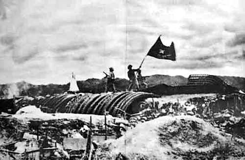
The victory of the Vietnamese
against the criminal French "Christians" on May 7,
1954 with the flag [47].
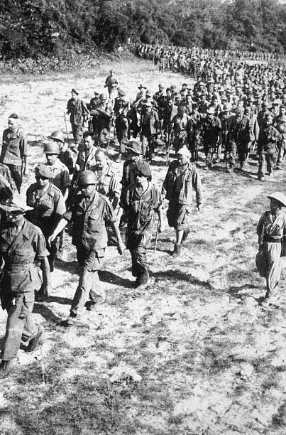
The battle of Dien Bien Phu is finished, about 3000
French prisoners are made, so stupid "Christians"
[48].
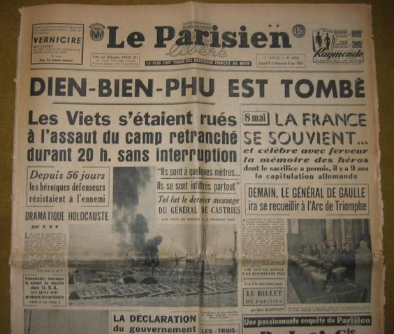
Vietnam is winning at Dien Bien Phu, a report in
newspaper "The Paris Man" ("Le Parisien"): "Dien
Bien Phu has fallen" ("Dien Bien Phu est tombé")
[50]
-- the 13th Half Brigade of the Foreign Legion lost
about 3000 men casualties in Dienbienfu, including two
lieutenant colonel commanders, also killing the worst
"Christian" bully boys from Germany, Scandinavia, also
Russians, Japanese and South Africans [and cleansing
the planet of these criminal "Christians"]. Quote,
"Former Legion Sergeant Claude-Yves Solange recalled
Dienbienfu:
"It may be immodest to say this about the Legion, but
in our ranks then the real war gods fought, and not
only the French, but also the Germans, Scandinavians,
Russians, Japanese, even a few South Africans. The
Germans passed the Second World War, and so did the
Russians. I remember that in the second company of my
battalion there were two Russian Cossacks fighting
near Stalingrad: one was a lieutenant in the Soviet
field gendarmerie (i.e. NKVD troops), the other a
platoon leader in the cavalry division of the SS (!).
Both died during the defense of the Isabel fortress.
The communists fought like hell, but we also showed
them that we knew how to fight. I don't think a single
European army in the second half of the 20th century
has been - and, God willing, never will be - able to
fight such terrible and large-scale battles hand to
hand as we do in this damned valley. The hurricane
fire of their artillery and the pouring rains turned
trenches and dugouts into a chaos, and we often fought
waist-deep in water. Their assault groups either made
a breakthrough or brought their trenches to ours, and
then dozens, hundreds of fighters fired knives,
bayonets, butts, pioneer shovels and hatchets."
[web01]
-- "The Battle of Dienbienfu lasted 54 days - from
March 13 to May 7, 1954. The losses of the French in
manpower and military equipment were enormous. 10.863
soldiers and officers of the elite French regiments
were captured. Only about 3290 people returned to
France, including several hundred legionnaires: many
died of wounds or tropical diseases, and citizens of
the Soviet Union and socialist countries of Eastern
Europe were carefully removed from the Vietnamese
camps and sent home to "shame their explosive labor."
Incidentally, they were much luckier than the others -
among them, the percentage of survivors was an order
of magnitude higher." [web01]
-- Parachute commander Marcel "Bijar himself called
the multi-day battle of Dienbyenfu as a "Verdun of the
jungle" and later wrote:
"If they had given me at least ten thousand
legionnaires, we would have survived. Everyone else
except the legionnaires and paratroopers were an
incompetent rabble, and it was impossible to hope for
victory with such forces."" [web01]
-- some captured soldiers were able to escape:
"Not all French units surrendered at Dienbienfu:
Colonel Laland, commander of Fort Isabel, ordered the
garrison to break through the Vietnamese positions.
These were the legionnaires of the Third Regiment, the
bullies of the First Algerian Regiment and the
soldiers of the Thai units. Tanks, rifles and heavy
machine guns were thrown at the fort - they went into
battle with light small arms. The seriously wounded
were left in the fort, lightly wounded were offered a
choice - join the assault group or stay and warn that
they would stop because of them and besides no one
would carry them. Laland himself was captured before
he could leave the fort. Algerians who stumbled into
an ambush surrendered on May 7. Captain Michaud's
column surrendered on May 8 and 9, pushing the
Vietnamese to the cliffs 12 km from Isabel, but 4
Europeans and 40 Thais jumping into the water through
the mountains and jungle still reached the location of
the French units in Laos. A platoon consisting of
abandoned tank crews and several legionnaires from the
11th Company left the encirclement after covering 160
km in 20 days. Four tank crew members and two
paratroopers from Fort Isabel escaped captivity on May
13, and four of them (three tank crew members and one
paratrooper) also managed to escape on their own. "
-- some criminal "Christians" in France still thought
they had to make movies about their criminal Vietnam
War (!). Quote: "In 1965, French director Pierre
Schönderfer (a former front-line cameraman captured in
Dienbienfu) made his first film about the Vietnam War
and the events of 1954 -- "Platoon 317," one of the
heroes is a former Wehrmacht soldier and now the
ensign of the Wildorf Legion." And there had to be a
second film adaptation of French war crimes in
Vietnam: "Dienbyenfu" (1992) [web01]
Vietnam NEVER attacked France
or the "USA."
[Supplement on Vietnam 1954: The Dictatorship Peace
of Geneva - Vietnam remains divided - and the
criminal French-"Christians" rearm again (!)
Officially, the "West" calls this dictatorship a peace
of the "
Indochina
Conference": May 8-July 20 1954:
"The
Indochina Conference was a conference on
the Indochina War and the Korean War held in Geneva
from April 26, 1954 to July 20, 1954. In addition to
the belligerents in the Indochina War participated:
France, the Việt Minh, the United Kingdom, the Soviet
Union, the United States, and the People's Republic of
China." [web14]
-- the criminal "Christians" with the criminal
"Christian" General De Gaulle etc. order the partition
of Vietnam in Geneva:
"As early as May 8, 1954, negotiations began in Geneva
about peace and about the withdrawal of French troops
from Indochina. After losing a long war against
Vietnam's patriotic movement, France left Vietnam,
which remained divided along the 17th parallel."
[web01]
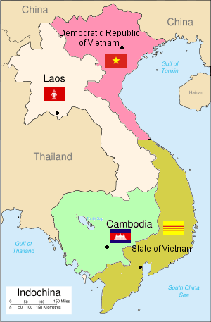
Map: 1954 Geneva Indochina Conference divides
Vietnam [52]
-- criminal French "Christian" Raoul Salan was only an
inspector in France in 1954, but was sent back to
Vietnam to command the reconquest as a general:
"Raul Salan, who had been fighting in Indochina since
October 1945, did not suffer the shame of defeat in
Dienbienfu: On January 1, 1954, he was appointed
Inspector General of the National Defense Forces, and
returned to Vietnam on June 8, 1954, where he again
led the French forces. But the time of French
Indochina has already passed." [web01]
The Mossad Wikipedia writes abiout the Indochina
Agreement:
-- on July 21, 1954, a school session was held at the
UN in Geneva with the reading of the "Geneva Accord."
-- the French troops withdraw from Vietnam, Laos and
Cambodia
-- the North Vietnam troops withdraw to the 17th
parallel leaving South Vietnam to the Emperor Bao Dai
-- free elections are to take place in complete
Vietnam in July 1956 under the supervision of
representatives from Canada, Poland, the Eastern Bloc,
India and non-aligned countries; an International
Control Commission is formed for this purpose.
-- the Pathet Lao may withdraw to Huaphan and
Phongsali, until an agreement with the Lao royal house
is reached [web14].
But see this:
-- after this conference, South Vietnam with dictator
Diem does NOT sign the Indochina Agreement [web14]
-- Salan returned to Paris on October 27, 1954, and
was deployed [by the criminal "Christian" Charles de
Gaulle] against the war of liberation of Algeria
beginning November 1, 1954 [and the war-mongering
"Christian" bully boy allowed himself to be deployed!]
[web01]
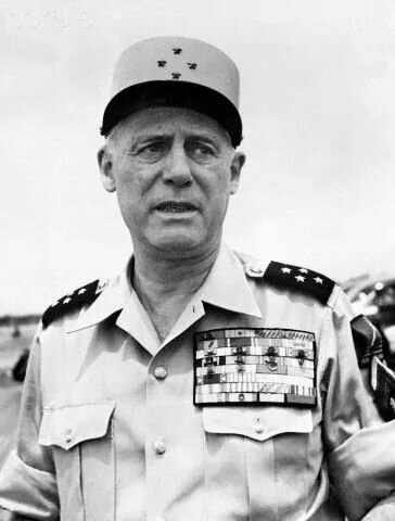 Raoul Salan, a
criminal "Christ" and General of France in
Algeria against Islam, 1960 appr. [51]
"After the withdrawal of the French and the partition
of Vietnam at the 1954 Indochina Conference, Giáp
served as Deputy Prime Minister of North Vietnam from
1955." [web06]
1956: NO elections in Vietnam
-- North Vietnam holds elections, but Dictator Diem of
South Vietnam refuses to hold elections, arguing that
the elections in North Vietnam were not "free"
elections
-- Dictator Diem says also that South Vietnam had not
signed the Indochina Agreement at all and therefore
did not have to hold elections. [web14]
1956-1960: Dictator Diem: Mass murder against
political opponents
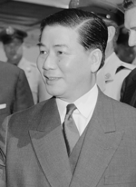
Dictator Diem 1960 [53]
See what he did with the opposition:
"The president further consolidated his position of
power thereafter by establishing two secret services
that spied on each other and he put close familiar
members on influential political. Diệm after taking
office, he brutally cracked down on communists and
other perceived or actual political opponents.
According to independent estimates, some 150,000
people were imprisoned and 12,000 were executed in
the years from 1955 to 1957. The president was
putting all major political groups into anger
against him by rejecting land reform deemed
necessary by the United States, he rejected forced
resettlement of the rural population, and he also
rejected a Catholic conversion campaign for South
Vietnamese which was considered necessary by the
United States. He countered oppositional efforts
with arrests and executions. Since partition, the
rivalry between the north and the south has grown
stronger. In 1959, communists were again sent to
South Vietnam, and in 1960 they founded the National
Front for the Liberation of South Vietnam (NFL),
which carried out armed actions in South Vietnam as
a resistance group." [web15]
And then in 1959, Dictator Diem is breaking the
Indochina Agreement and as a reaction the Ho Chi
Minh trail is back into operation officially:
[Ho Chi Minh Trail again
improved since 1959 against Diem troops of South
Vietnam]
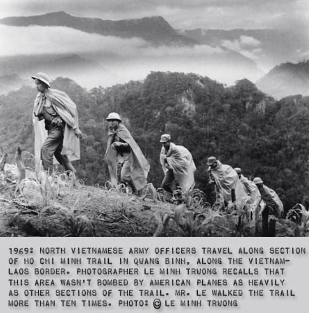
<On May 20, 1959, Truong Son military corps No.
559 was set up. Its combatants continued the
lengthening and widening of the path, advancing in
Indian file, their heads a little inclined, their
bodies rushing forwards; weapons and ammunitions,
confidential documents and first-aid medicines all
put in dossers [dossers are native local people] on
their backs. The man marching ahead gently separated
the leaves and grasses with a stick, lest they be
torn. The second man followed suit; but the last man
walked backwards to restore the original state of
the leaves and grasses with his sticks.
In 1959 there was only a battalion of 600 men who
silently marched in this way making sure "to avoid
contact with the people and the sight of the enemy,
and to keep absolute secrecy of the mission".
Groping their (p.46) way with great effort, they
could advance only about 20 kilometers in one day.
The Ho Chi Minh Trail had begun to take shape in
this primitive way.> (p.47)
It can be said
that after 1954, the development of the Trail
was closely related to US [monkey] aggression:
-- Phase 1 (1959-1965): The Geneva Agreements
were scraped; US missions and part of US
troops entered South Viêt Nam. The restoration
of the liaison line was to be continued.
-- Phase 2 (1965-1968): Half a million GIs
entered South Viêt Nam. The nature of the war
changed. The motor way system was built for
the use of motor vehicles. The Têt Mâu Thân
1968 campaign [campaign against the monkeys]
culminated this phase.
-- Phase 3 (1968-1975): The US applied the
Nixon doctrine and played for time at the
Paris Conference. Viêt Nam had to step up the
construction of the Ho Chi Minh Trail into a
system of Three-trunk lines, as explained
earlier.> (p.65)
[Here are details]:
[Ho Chi Minh Trail against "U.S." troops - the
Trail is improved for transports with big
vehicles]
<At the time of the anti-US resistance, it was
associated with the image of the groups of
road-builders. Each group was made up of
road-builders and composed at most of 15 strong,
sturdy, well-trained and absolutely loyal youngsters
from 18 to 20 years of age. many of these men had
great experience in operating in areas where the
supply line would pass through, or they were natives
of the Truong Son area. Enthusiastic, brave, and
intelligent, they did not fear sacrifice and
hardship. They knew the terrain well but their first
forays were difficult and dangerous. (p.47)
Being aware that the South Vietnamese battlefield
needed great support from the North, the US and the
Saigon administration deployed their troops in
innumerable posts along the way of the North
Vietnamese forces. For instance, the Ho Chi Minh
line has to cross the 300-km-long Highway No 9,
which links Dông Hà town (Quang Bình province) to
Khe Sanh and the provincial capital of Savannakhét
of Laos, via Lao Báo and Shepone. It is an asphalted
highway built long ago by the French, widened and
upgraded by the US and the Saigon administration,
and made very suitable for motorized transport.>
(p.47)
[Tactic: marching when the enemy is sleeping - Tà
Ôi natives passing difficult parts of the Ho Chi
Minh Trail]
<Many of its portions run parallel to the Cham Lô
River to make it all the more difficult for the road
builders to cross. Yet the latter intelligently
chose the most propitious moments when the enemy
relaxed their vigilance and secretly passed just at
the foot of the enemy post. At other times they hid
(p.47) themselves in the culverts [tunnels] or they
took the torturous path that was only taken by the
robust Tà Ôi (a minority mountain people of Quang
Tri who have the custom of climbing up tall trees to
obtain honey and aquilaria, to pick precious
medicinal plants for the treatment of the sick, and
to catch rare birds for the cult of local genies).
Now they took refuge in strange grottoes full of
bats, deep between high stone walls. Looking up from
the bottom, they could only see menacing stone
teeth, thickly entangled lianas and tree roots. Now
they passed through forests of cutting nettles from
which they came out with scratched faces and
maddening itching fits.> (p.48)
[Crossing of Highway 9 (from Song Hoi to
Savannakhét) passing little tunnels]
<When they had to cross Highway No 9 by passing
under culverts [tunnels], they had to watch the
activities of the puppets troops throughout the day.
Normally after 18:00 hrs the scouts could easily be
guided to pass the culverts, except they had to
breathe the foul air therein. they make no noise so
as not to arouse the enemy's suspicion. After
crawling out of the culverts, they had to cross the
Cam Lô River by three basket-shaped boats, each
capable of transporting three men and three dossers
[local people] of goods. Each night 100 men and 100
dossers [local people] were ferried across on
average.
Thereafter, the troops hid themselves in the forest
or in a deep gully. The scout who marched in the
rear had to wipe out all traces on the embankment,
bury or hide the boats. Should a combatant be killed
by a stray bullet, his body would be secretly buried
at once. Should he be captured, he would suffer all
kinds of torture without revealing his mission.>
(p.48)
[Weapon transports by Ho Chi Minh Trail
1959-1960]
<The secret opening of the Ho Chi Minh Trail
achieved good (p.48) initial results: after 500 days
and nights, from July 1959 to December 1960, the
battalion 301 of the Vietnamese People's Army had
conveyed 21,000 fire arms, such as mortars, machine
guns of various calibers, hundreds of tons of food
and medicine, and over 2,000 cadres of all levels.
The trail was expanded more and more towards the
Laos frontier, and down to the Cambodian frontier
and the Plain of Reeds in Nam Bô, as far as the
southern-most point of South Viet Nam.> (p.49)
[Very important help of natives against France
and "U.S.A."]
<The history of the Ho Chi Minh Trail is not only
connected to that of the first units commissioned as
far back of the ethnic groups on either side of the
Truong Son Range: the Tà Ôi, Vân Kiêu and Gia Rai.
Not only did they participate in guiding the troops
and in finding the easiest way for them to go South,
but they also found caves and grottoes for storing
war materials, places for the troops to rest or seek
refuge. They even contributed to defending "Uncle
Ho's Line", which had won the hearts of the people
along the Truong Son Range. Moreover, the line ran
across the Western Truong Son to friendly Laos and
received their wholehearted support.> (p.49)
In 1960,
dictator Diem survives a coup, and military
members who are not flying to Cambodia get their
trial in 1963 [web15].

Dictator Diem in 1960 after the military coup [53]
[Collaboration with Laos against French and
"U.S." troops - Lao native woman-cadre "Ilit" from
Savannakhét organizing support for Vietnamese and
healing malaria with larvae from termite hills]
<Many commanders of the Army Corps 559 in October
1963 and later still remembered a Lao woman-cadre
named Ilit in [the town of] Savannakhét (Central
Laos) who mobilized the Lao ethnic groups to offer
tools and food to the Vietnamese troops and to build
the part of the line on Lao territory. Ilit won
great credit in taking care of the Vietnamese
soldiers, feeding them, mending their clothes, and
helping them transport supplies through waterfalls
and forests. Together with a number of Lao women,
she also took larvae from (p.49) termite hills to cure
Vietnamese soldiers from malaria. She cooked
soup with termite larvae and earth worms to feed the
patient. This recipe has been used until now by
Vietnamese soldiers. [Criminal "US" NATO had no idea
how to heal malaria and their fighting animals were
suffering of malaria without end]. (p.50)
When parting, many soldiers emotionally asked Ilit
why she had been so devoted to them. She candidly
answered that she felt it her duty to assist her
friends, since to fight imperialist aggression was a
common cause of Viêt Nam and Laos.> (p.50)
[Vietnam War ("American" War) against "U.S.A.":
natives of Laos helping the Viets]
<In their march southward for the subsequent 13
years, tens of thousands of Truong Son troops had
been assisted by the Lao ethnic groups in the Kham
Muôn, Savannakhét and Attopeu Provinces and by the
Cambodian people in the Stungtreng, Rattanakiri and
Mondunkiri Provinces also for the common cause of
fighting against US aggression for national
liberation.> (p.50)
From the chapter 8
Epilogue:
[1963: Helpless criminal
President Johnson - project to destroy
the Ho Chi Minh Trail - "intruders"]
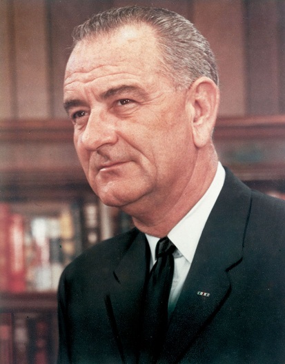
"USA" with criminal "Christian" President Lyndon
B. Johnson 1963 [59]
<Powerless too were the
Pentagon and the [racist and arrogant] White
House. During the war, the Ho Chi Minh Trail was a
big headache. On 23 November 1963, during the
first month of his presidency [after the Kennedy
murder], L. Johnson was presented a report on the
Ho Chi Minh Trail by his national security
adviser, Bundy. This was a sore [aching] subject
of the US in the Indochinese countries. Johnson
accepted Bundy's proposal to remove that dangerous
umbilical cord, although this undertaking would
take a lot of effort, money and time. And from
1963 onwards the US used every means to destroy
the trail with increasing fierceness and
continuity. (p.104)
In fact, throughout 1963, US
intelligence officers in Thailand, Laos and Saigon
did their best to draw on a map the course and the
features of the Ho Chi Minh Trail. ON 21 December
1963, Defense Secretary McNamara addressed a long
memorandum to President Johnson.
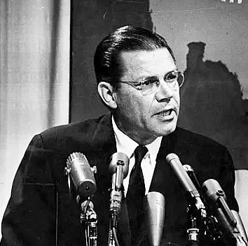
"USA" Ministry of Defence criminal "Christian"
McNamara 1965 [60]
Point 5 of this memorandum dealt with the
"intrusion" of North Viêt Nam through "corridors",
the middle portion (p.104) of the Mekong River,
and the southernmost cap of South Viêt Nam.
McNamara requested the urgent making of air maps
by U2 planes concerning Laos and Cambodia to
determine the "intrusion corridor" and to expand
the hard-brunt campaign of detection and
destruction by spies and commandos.> (p.105)
[Helpless criminal President
Johnson: "U.S." spy commandos are mostly killed]
<Commandos were organized into
groups of eight members each. They were carefully
chosen from the thug-like US soldiers. Other
groups included US and South Korean soldiers. All
were specially trained, the most fundamental
lesson was grasping the map of [the mountain range
of] Truòng Son. Throughout 1964, tens of such
commando groups were dispatched to the trails on
the Truòng Son Range, but nothing resulted. There
was a complete lack of information. Members of the
commando and spy groups were also not heard of and
the very few survivors who returned were only
guards or sentries [wards]. The author of the book
"Ho Chi Minh Trail" [of 1972 after the "U.S."
defeat] relates one of the trips made by a US
commando group, when only one survivor returned.
The duty of the group was to find any portion of
the trail and to observe what was happening there.
The survivor said:
"I did not see anything" (because
he stood guard in the distance). Yet he could hear
the noise of many tracks running in the area.
Apparently, the heavy tracks were numerous.>
(p.105)
[Helpless criminal President
Johnson: attacks against Ho Chi Minh Trail in
1964 - plan 34A - and carpet bombings]
<On the basis of such
information attacks against the Truòng Son were
stepped up under the 34A plan start in February
1964. The plan was heavy; U2 planes would make
surveys and take photos of Laos and North Viêt
Nam, North Vietnamese and Lao individuals would be
kidnapped to get information and documents,
commandos would be parachuted for sabotage
(p.105). Under the command of General Harkin, a
squadron of forty T28 planes was set up. They
bombed 23 points of the corridor line during the
year 1964. Carpet bombing by B.52's were also
carried out to destroy all manifestations of life.
(p.106)
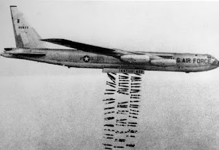
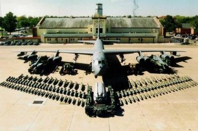 B52 bomber with carpet bombing
[57] - B52 bomber with it's load of bombs before
loading [58]
[Where the B52 were stationed and loaded against
Vietnam? in Thailand!]
The US efforts in finding out the
mysteries of the trail are recorded in detail in
the book "The Air War in Indochina" by Cornell
University researchers on the air war.> (p.106)
[Helpless criminal President
Johnson: Ho Chi Minh Trail converts into a
testing zone for new electronic inventions:
"detecting gadgets"]
<The US preventive measures on
the Ho Chi Minh Trail met with difficulty because
the North troops and supplies were conveyed during
the night when the targets were not visible for
planes. Electronic techniques were applied to
detect targets in the night. The Ho Chi Minh Trail
practically became a laboratory to test and to
improve the structure of an electronic
battlefield. (p.106)
to detect the movement of
vehicles and men on the trail, detecting gadgets
were buried in the ground or hung on trees by
planes. Planes in flight received signals from
these gadgets and transmitted them to a control
station equipped with computers. Then bombers were
called to the determined area. To prevent the
vehicles from escaping, a special type of plane
was developed, the gunned airship provided with
infra-red night time detecting means.> (p.106)
[Helpless criminal President
Johnson: destroying roads without effect]
<Another preventive action was
to destroy the trail itself and not the transport
means rolling on it. This action was not effective
because road repairing was quick except when
important places (ferries, culverts [tunnels],
bridges, dykes) were hit by bombs. Most of the
preventive attacks were carried (p.106) out by
fighter planes, but B.52s had been used in large
numbers. These "flying fortresses" can "clear up"
large areas and uproot trees and plants covering
the roadways, causing earth to crumble and block
the traffic. Lastly, B. 52s often attacked areas
suspected to be storing facilities or motor
vehicles parks. There were about 1,000 sorties of
B.52 planes, occurring monthly in Indochina and
mainly used for the purpose of destroying the Ho
Chi Minh Trail.> (p.107)
[Since 1964 building highways to Nam Bô -
Highway Nº 15]
<Before 1964, no one, not even the officers and
men of the Truòng Son corps, could imagine building
a highway along the length of the range. But only a
few years later, a system of highways had reached
the war zone of Nam Bô, through valleys and
mountains.> (p.50)
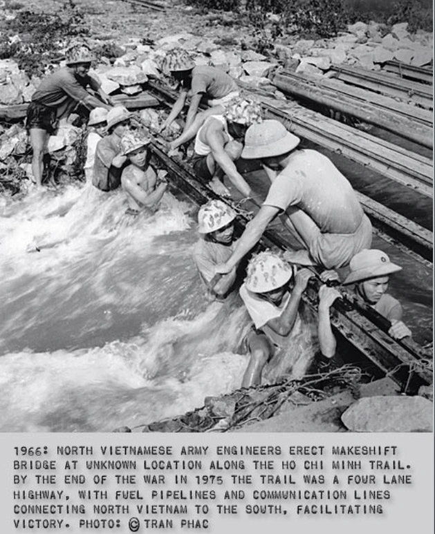
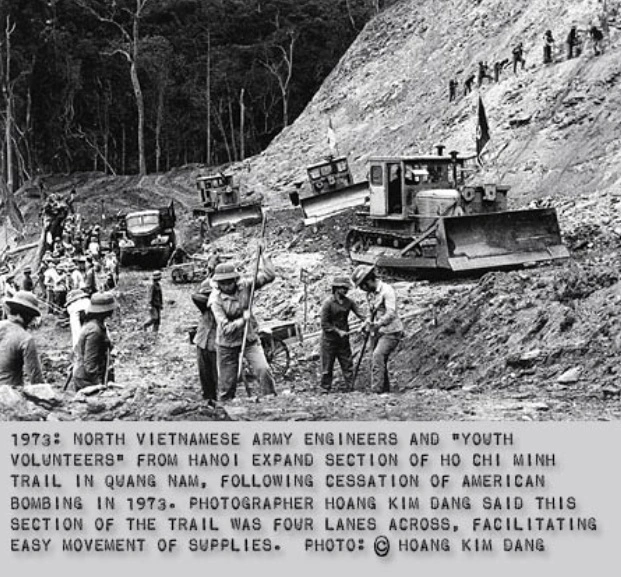
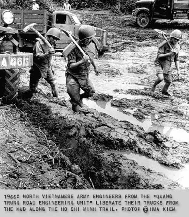
Bridge
construction on Ho Chi Minh trail1966 [54] -
Road construction on Ho Chi Minh trail1973 [55]
- Ho Chi Minh trail, trucks need to be cleared
of mud 1966 [56].
A portion of the road, leading from Tân Âp and
Cu Nãm
(Quang Bình Province) to Highway No 15, via the Lùm
Bùm three ways crossroads, meanders around the
famous bomb pockets of the anti-US war. The
different routes A, Me Con, and Tay Áo traversed
three submerged pontoons in Ta Lê, and climbed up
the Pu-La-Nhich Pass, which is a few kilometers
long.> (p.50)
[Highway Nº 20]
<The Truòng Son small pathway, also called Quyêt
Tháng Road No 20, is the first (p.50) and the most
important road accessible to motor vehicles in the
Ho Chi Minh Trail in West Truòng Son. Quyêt Tháng
Road No 20 is a system of four roads respectively
named A, B, C, and K. Even during the fiercest days
of the war, in spite of continuous spying and
bombing by enemy planes, roads A, B, and C succeeded
in ensuring the transport of needed supplies and
troops and also for large-scale military campaigns.
Only Road K, running through forests, could allow
transport in day time.> (p.51)
[All other transports were performed during the
night in the darkness, and any defoliation action
intoxicating large parts of the jungle and humans
did not change anything with the transports during
the night].
[Highway K - narrow road passing perennial
forests - branches bent down with stones]
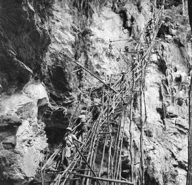
<It can be said that all the roads of the Ho Chi
Minh Trail system were kept secret during the war
against US aggression for national salvation.
However, road K was the most secret of all. It was
used for motor vehicles and had a total length of
about 2,000 km. This was a narrow road, wide enough
for only one truck, running through perennial
forests and therefore covered by foliage. If it
passed through thin forests, the road-makers would
join the foliage by tying heavy rocks to the
branches to bend them down.> (p.51)
[Exposed parts of Highway K with wards]
<Portions of road K were exposed because they
followed the bed of a stream (already leveled by
army engineers, of course) or passed through a clear
forest of an open expanse of rocks. However, these
portions were not long and strict regulations had
been laid down for being allowed to drive on them.
For instance, during daytime, at both ends of these
segments of the road, there had to be watchmen
posted in two-km intervals from each other, ready to
fire gunshots to warn the truck drivers that the
swirls of dust deposited on the trees might easily
cause the enemy planes to detect them. Moreover,
when allowing the (p.51) traffic, the watchmen were
required to make sure that enemy spy and fighter
planes were not operating the region and the
surroundings.> (p.52)
[Transports during the day with fog,
clouds or rain]
<During normally enemy resting hours, when the
morning was foggy, or when it was cloudy or raining
at dusk, the vehicles operated freely.> (p.52)
[Example of Highway K: post Nº 32 near Ta Lê
River with pontoon and bombing and spraying -
building of another road]
<All the sectors of road K were not built at the
same time but according to the practical
requirements of coping with the enemy's new
weaponry, under the Direction of the Corps 559
Command. For instance, the portion belonging to post
Nº 32 was constructed in 1969 when the submerged Ta
Lê pontoon was blocked. The pontoon was covered by
the water of the rather narrow Ta Lê River.
Previously, this area was covered by a thick forest
of tall trees which concealed the existence of Quyêt
Tháng Road Nº 20. Yet, the US and the Saigon
administration repeatedly bombed and sprayed so many
toxic chemicals that all vegetation was completely
destroyed; only red-soiled hills were left.
Some hills were fairly high, such as the hill to the
south of the pontoon B, which was bombed hundreds of
times. The hill was flattened but it continued to be
pounded hundreds of times more. Once the US and its
agents used several scores of planes to blast the
pontoon before they announced the halt of bombing
above the 20th parallel, allegedly to show good will
and to start negotiations in Paris. They also
mobilized 12 B.52 bombers to attack on 12
consecutive days during which 6 B.52s came every
hour to carry out carpet bombing. Between two B.52
bombings, fighter planes and C.130 transport planes
came day and night to drop their deadly (p.52) cargo
indiscriminately. A wide area was kneaded into mud.
Transport became extremely difficult causing the
Corps 559 Command to order the construction of
another covered road.> (p.53)
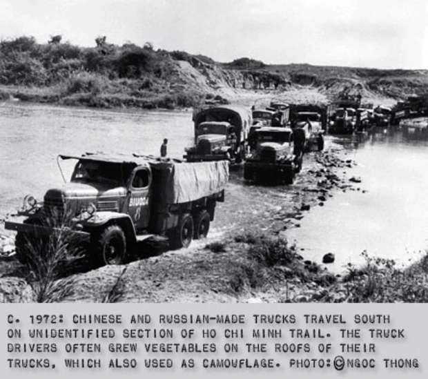 Ho Chi Minh trail: Russian and
Chinese trucks crossing a river on a ford - 1972
[66]
[We can see that the
"U.S." command with it's bombings was for NOTHING
but it was provoking only more resistance].
[Floating bridge dismantled and camouflaged
every day with flowers]
<All the military posts in Truòng Son had their
own covered roads, the longest was that of military
post Nº32. Each covered portion of the Ho Chi Minh
Trail had its own features. For instance, the
covered section joining military posts Nº 31 and Nº
32 was 10 m wide and ran through a deeply submerged
pontoon; on either side were gently sloping stone
walls (about 350). A floating bridge was made, which
was dismantled in the daytime and restored at
nightfall. The pontoon was camouflaged by rows of
living trees with evergreen leaves; over the trees a
thick trellis was firmly arranged and plentifully
hung with orchids.> (p.53)
[Example: post 33 surveying 48 km with 9 rivers -
4 hours for 8-15 km]
<For its part, military post Nº 33 had a 48
km-long portion of covered road, which ran across 9
streams of different depths. That is why it was
called the "9-stream road". There were only 9
streams but, because of their winding course, the
trucks had to ford [passed] a few dozen times. The
9-stream road was considered extremely difficult for
truck drivers. Therefore the Corps 559 deputy
commander had to personally direct its construction
in December 1971. The section was only 8-15 km long
but it took four hours for vehicles to cover it.>
(p.53)
If we say that the Ho Chi Minh Trail begins at
Highway Nº 9, it will be impossible to know all the
radiating roads. Because there were 6 entries to the
trail under the control of military posts 14 and 31
(p.53), and the roads formed an entangling
network like a cobweb. Each entry had its importance
and constitutes a target for US-puppet bombing. Each
was fraught [charged] with danger.> (p.54)
[Night traffic]
<Traffic was forbidden during the day-time. It
was the rule for 10 consecutive years (from 1964 to
1974) that truck drivers operate in the night with a
yellow light under their machine to avoid detection
by enemy planes. They could run during the day-time
when they crossed the Mây Pass (Cloudy Pass) on
Highway Nº 16, since the yellow light was
undetectable in the clouds. The Mây Pass is rather
high and humid, but throughout all the years no
accident ever occurred.> (p.54)
[Example: 2 trunks A+B, code 128]
<Another section coded 128 included two trunks, A
and B; it ran southwards, close to Highway Nº 9. It
also met Quyêt Tháng Road Nº 20 near the Pu-La-Nhich
Pass. Truck drivers on this section of the road
would never forget the rumbling Xê-Bang-Hiêng River
in Laos or the Tha Mé Pass with the Tha Mé pontoon
or the Ban Khôc and Thác Nang submerged bridges;
they were subjected to fierce bombing raids. When
they luckily took the covered roads, they did not
have to ford rivers but they were still threatened
by enemy bombing. If they managed to get out of the
pontoon, they could press the gas pedal and run
freely on the windy Attopeu plateau. Normally the
higher they climbed on the Truòng Son mountains, the
lower they would slope down. But here it was plateau
land; they had only to determine the direction they
were heading for and find their way to go across the
old forests.> (p.54)
[Example: road Nº 35 with Navarre Road]
<Going further Southward, also in West Truòng
Son, the traveler will find road Nº 35 which is
linked with Road Nº 128 and near a portion built
during the war against the French colonialists.
Truck drivers called it "Navarre Road". Many
portions of Road Nº 35 coincided with Navarre Road
to lead to the Indochina three-way crossroads; some
portions are only 30 km away from Kontum Town.
Taking Road Nº 35, truck drivers would cross the
Xê-Ca-Máng, Cê Xu pontoons, and the US bombing
targets at the Ang Bum Pass, the 9-stream road,
Savannakhét, Attopeu (of Laos) and Plây Khôc
District of Kontum.> (p.55)
[Example: road Nº 49 and 128 with
transports from Cambodia because of shortage of
food and medicine by "U.S." bombings]
<Road Nº 49, also linked with Road Nº 128 at the
Xê Scu three-way cross roads, originated in Tà Ngâu
on the Cambodia-Laos frontier. This is the road for
the transport of the (former) socialist countries'
material aid and the supplies bought in Cambodia,
from Sihanouk Port city to North Viêt Nam, to Tây
Nguyên, to the 5th war zone and to troops of the
Truòng Son Corps in the South.
Road Nº 49 was opened by Regiment 98 under the
command of major Phan Quang Tiêp. This regiment had
just completed the construction of Road Nº 128 up to
the Tài Xèng three-way cross roads; it hardly had a
break before it was ordered to build Road Nº 49
because, during the 1965-1966 dry season, the US air
force carried out hundreds o sorties to block the
conveyance of supplies to the Liberation Army. At
that time, North Viêt Nam could only meet 30% of the
battlefield's planned requirement in food, medicine,
commodities and war materials. Ten of thousands of
soldiers in South Viêt Nam suffered from food
shortage and illness.> (p.55)
[Building road Nº 49 with losses and malaria -
delivery of food and medicine coming from
Cambodia]
<Road Nº 49 was built in a year from March 1,
1966 to March 30, 1967
-- for the urgent transport of 10,000 tons of rice
and 2,000 tons of foodstuffs to the point of entry
of C4 Tà Ngâu and
-- of emergency support for the Tây Nguyên
battlefield, the 5th war zone, military post Nº 34
and others further South.
It went without saying the suffering and hardship
overcome by the combatants of Regiment 98, as
evidenced by the following figures: from April to
June 1966, 15 soldiers were killed and 150 were
wounded by US air strikes. Up to July 1966, 35% of
the Regiment had suffered from malarial epidemic, or
more precisely, malaria had in turn affected the
entire Regiment.
Up to late 1966 and early 1967, the Regiment had
lost 150 officers and men to malaria. However, Road
Nº 49 was somehow completed on March 29, 1967, one
day ahead of schedule. On April 4, transport
battalions 54, 55, 58, and 59 entered Tà Ngâu one
after the other to bring emergency supplies in time
to Tây Nguyên and the 5th war zone. Over three
months, thanks to the availability of roads, the
transport units of North Viêt Nam brought to Tây
Nguên over 8,000 tons of food and thousands of tons
of gasoline. The liberation troops maintained the
point of entry Tà Ngâu until the end of 1970 for the
reception of international support and the purchase
of goods in Cambodia (over 60,000 tons of rice and
about 10,000 tons of foodstuffs and other
necessities, in particular 5,000 tons of gasoline
for motor transport means).> (p.56)
[Road system in the eastern part of the
Vietnamese mountain range of Truòng Son -
"East Truòng Son road network"]
<The aforesaid [mentioned above] roads are the
most important of West Truòng Son. In East Truòng
Son there is another road network. In Quang Bình it
includes (p.56) two branches. The firs branch is
National Highway Nº 1 at Bên Hai. It joins with the
first section of Highway Nº 9, then it turns
southwards. The second road starts from Vính Châp
Commune, Vính Linh District, to join Road Nº 49 to
Cam Lô then turns to Highway Nº 9. From Tà Con,
which produces plenty of pineapple and lemon, the
East Truòng Son road network advances further and
further south, leaving behind A Sâu and A Luói
Districts, to become a steep, slippery slope leading
to Thuong Dúc and then the Thao and Giàng regions.
Next, it joins Road Nº 14. (p.57)
After the victory in the Southern Laos battlefield,
in 1972, this trans-Viêt Nam road was put to use,
but only in short sections. More precisely, the East
Truòng Son road network was completed in early 1975.
This is a long corridor from Highway Nº 9 to Eastern
Nam Bô, the result of the tremendous efforts of over
30,000 soldiers and vanguard youths coming from all
parts of the country, primarily from the provinces
of North Viêt Nam.> (p.57)
[Girl battalions - building of rafts to ferry
tanks]
<In East Truòng Son, the construction of roads
was initially entrusted to the vanguard youths,
particularly to young lads. There were companies,
even battalions of road builders exclusively
composed of girls. Sometimes they did not see any
men all the year round. The army engineering units
were called for only in high passes or deep
pontoons. In October 1964, 12 girls of the vanguard
youth assumed the difficult job of making rafts to
ferry trucks across the Sê-Bang Hiêng River. Late in
1964, tens of kilometers of (p.57) roads accessible
to motor vehicles were completed to link Highway Nº
9 to Sa Di, crossing the Sê Bang-Hiêng River at Ban
Dông. This was the time when 2,000 combatants of
Regiment 98 were building roads; their rice stocks
were exhausted and the Tri Thiên battlefield also
needed emergency supplies. Moreover, the rainy
season made the Sê-Bang Hiêng River swell. Trucks
could no longer ford it at Ban Dông to bring
supplies to the South. (p.58)
Faced with the pressing demand of the battlefield,
the Corps 559 Command decided to make rafts to ferry
the trucks across the river. In Regiment 98, there
was only one road-building engineer and no soldier
capable of doing wood work; as a consequence; the
sawing of logs was carried out with great
difficulty. Fortunately, Miss Suong and a group of
lads in the vanguard youth had a good knowledge of
carpentry. They volunteered to accept the strenuous
and skilled work. And in one day, they sawed enough
sections measuring 0.35 m x 7 m to make the frame of
the raft. After three days the flooring boards and
the bridges of the raft were completed, and in
another day, a 4.5 m wide and 8 m long raft and its
two bridges were completed.> (p.58)
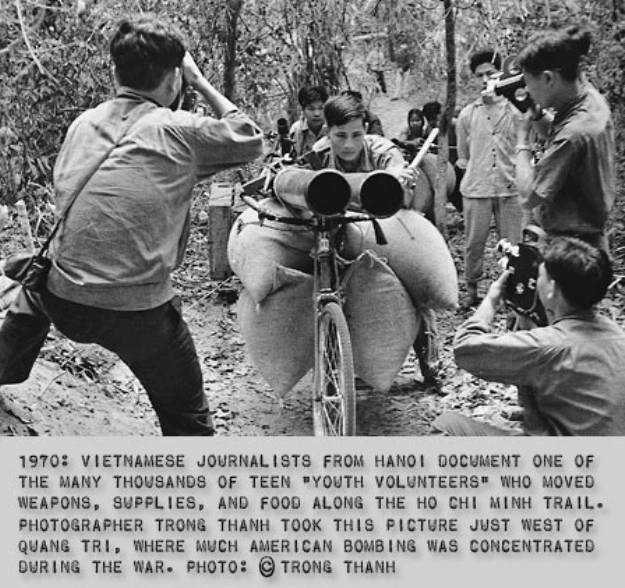
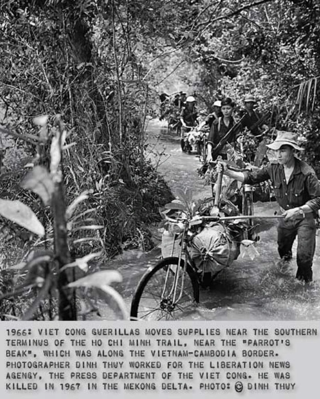
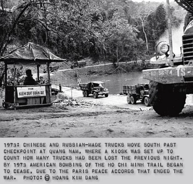 Ho Chi Minh trail: youth group
with bicycle transports 1970 [63] - Ho Chi Minh
trail: bicycle transports through a flood 1966
[64]
Ho Chi Minh trail: Russian and Chinese trucks
passing a kiosk where trucks are counted 1973 [65]
[The cable ferry - shifting trucks and rice
during the night]
<After the construction of the raft, the
battalion of vanguard girls took charge of the
manual operation of the ferry (by means of cables)
across the fierce current. During the whole first
night, the girls did not sleep a wink as they
ferried 60 trucks and 240 tons of rice to the South.
For the next seven days, in spite of the river being
in spate, they continued their work, ferrying 400
trucks and 2,000 tons of rice to the South.>
(p.58)
[Kitchen smoke provoking bombing by monkey
"U.S." military - bombed Dông Tiên slope without
end]
<During the first days of road making, the army
engineering units, particularly the vanguard youth
[pioneer youth], did not strictly respect the
regulations laid down by the Corps 559 Command. As a
result they suffered losses that could have been
avoided. In April 1964, the battalion of vanguard
youth of Nghê An opened the sector from Dông Tiên
slope to Cha An of Quyêt Tháng Road Nº 20. While
cooking their meal, they let smoke rise up and thus
were detected, bombed, and strafed [attacked in a
low height] by three US planes. (p.59)
The 500-youth battalion was drowned in fire and
flames: 7 were killed and 17 wounded. This was an
experience broadly publicized to all units by the
Corps 559 Command. Such losses never happened again.
However, the enemy still suspected the presence of
Vietcongs in the raided area, and for 100 subsequent
days they continuously attacked the Dông Tiên slope.
The Nghê An youth stuck to the roads; 25 more were
killed and 30 more wounded, but the road was
completed three days ahead of schedule. (p.59)
The battalion was awarded the first class war-deed
medal by the State. This was the battalion
representative of the 10 vanguard youth battalion of
the former fourth zone including Quang Bình, Hà
Tinh, Nghê An and Thanh Hóa which built Roads Nº 20,
128, B45, B46 of the Ho Chi Minh Trail and which,
together with the army engineering units E98, E10,
E4, E5, and E229, had completed three strategic
North-South trunk roads in the Truòng Son Range,
overcoming innumerable obstacles and hardships,
making sacrifices, and suffering losses.> (p.59)
[East-West connections in the Vietnamese
mountain range of Truòng Son]
<The difference between the East Truòng Son and
West Truòng Son roads was the fact that the former
(p.59) was accessible throughout the rainy season,
although dangerous because of the slippery slopes,
and covered less mountain terrain than in West
Truòng Son.> (p.60)
[Example: transversal roads B45 and B46]
<East Truòng Son and West Truòng Son roads ran
almost parallel along both sides of the range.
Vehicles moved on the western side in the dry season
and on the Eastern side in the rainy season. Besides
these truck lines, there were transversal roads
coded B45 and B46. (They also had exposed sections
or they had to cross forests of young trees not
suitable for the forming of shelters. In this case,
trunks of banana trees were used [as covering for
the street], as in the case of the 179-km-long
transversal Road Nº 29 in west Truòng Son which runs
over the Tâm Dân mountain to A Sáu, A Luói in East
Truòng Son.> (p.60)
[More details]
<We have not mentioned the branch roads, roads
with round-abouts [detour, indirection] for avoiding
air raids or hiding the vehicles, roads leading to
stores, even roads constructed with a great deal of
blood and sweat, then camouflaged for diversionary
purposes. We have not mentioned the rivers lines in
the Truòng Son Range. They contributed to perfecting
the multi-form and multi-direction Ho Chi Minh Trail
system.> (p.60)
[Statistics: 13,645 km of roads]
<Counting only the motorways, according to
published figures of 1976, the Ho Chi Minh Trail is
13,645 km long, including 260 km of macadam [natural
with gravel] roads. It is composed of 5 systems of
longitudinal trunk roads (total length 5,530 km), 21
transversal trunks roads (total length 4,019 km), 5
systems of entry-point roads (total length 700 km),
round- (p.60) about roads [detour roads] avoiding
places of enemy high bombing activity (total length
4,700 km), and a system of covered "K" roads running
all the length of Viêt Nam (total length 3,140 km).
The construction of the "trail" was mainly carried
out in 1973 [1963?] -1975. The Truòng Son troops
opened 785 km of roadway, removed 21,000,000 m3
of earth and stone, laid asphalt over 73 km,
constructed 2,080 m of permanent or semi-permanent
bridges and 10,211 m of culverts [little tunnels].
So the total length of the Ho Chi Minh Trail amounts
to 20,000 km, a huge length of roads built during
the war.> (p.61)
[Pathways for couriers on foot]
<In addition to the aforesaid motorways, there
are everywhere endless pathways in all directions,
on both sides of the Truòng Son, for couriers on
foot. They reach as far as Laos and Cambodia and
they only bear the footprints of men and wild
animals. They constitute pathways of marvels
for explorers wishing to carry out detached research
on Truòng Son, on the ethnic groups, the grottoes
and caves, and the fauna and flora there. They form
a thick network like cobwebs starting from Bãi Hà in
Quang Bình Province, which was a regroupment place
for new recruits in preparation for crossing the Bên
Hai River. From Bãi Hà, mounting up the Truòng
Son, the courier can go to Nguyên Chì Tanh slope
(General of the Viêt Nam Army who has passed away)
or to the all-the-year-round foggy and windy
frontier post of Cha Lo. (p.61)
It is clear that the tourist may see many things
other than merely a communication line.> (p.61)
The Ho Chi Minh Trail can meet any tourist's desire
to look for strange and mysterious (p.61) things. He
will come by various convenient means of transport:
walking, motor vehicles, elephants / horses,
hammocks, palanquins, boat and airplanes.> (p.62)
[Secret gasoline pipeline since 1965 -
gasoline in nylon bags, bamboo stems and barrels
before 1965]
[Over 16
years, engineers, soldiers and volunteers built
20,000km of roads, 1,400km of oil-and-gas
pipeline, 3,140km of hidden paths for vehicles to
pass during the daytime, plus thousands of smaller
bridges and drains. VNA/VNS Photo Văn Sắc].
[web17]
<The tourist will be surprised by a pipe
line which can withstand all enemy attacks, pass on
terrains and lie underground from West Nghê An to
East Nam Bô, the length of the Truông Son Range. It
[this secret pipeline] played a significant part in
the rapid and timely supply of gasoline to the Ho
Chi Minh military campaign.
Before 1965, to supply gasoline to the South Viêt
Nam battlefields, the Truòng Son troops had to put
it in nylon bags, carry these bags in their
knapsacks, and walk. Gradually they took the
initiative to put gasoline in bamboo stems and in
barrels and to float them on river currents to their
destinations. This way of conveyance was disperse
but less risky than by tankers because of the
feverish attacks by enemy planes along the Truòng
Son. A machine gun bullet or a pellet could set the
whole tanker in flames. (p.62)
During the years following 1965, North Viêt Nam was
still faced with great economic and technical
difficulties to start the building of a North-South
pipeline. In stores for materials there were only
about 200 km of pipes and technicians (p.62) for the
laying of the line were not available, particularly
for a line thousands of kilometers long. Then the
engineering plants in Hanoi (Hà Nôi) (particularly
the medium-scale plants and the Trân Hung Dao plant)
were ordered to make pipes and priming pumps
suitable for use in [the mountain range of] Truòng
Son. And the operation of the pipe line was
organized; qualified technicians all over North Viêt
Nam were recruited; the first army unit of Truòng
Son oil-and-gasoline workers came into being. They
went to Truòng Son to explore the terrain, not
following the trail opened by the Army Corps 559.
They found the track for the line by themselves,
carrying out a new exploration. Topographical
surveys and maps for the laying of pipes were sent
to the North for approval and the fabrication of
pipes and priming pumps were stepped up.> (p.63)
["U.S." monkey military spies are searching the
gasoline pipe line - beginning of operating
on August 25, 1968]
<In these three years, the US intelligence center
[criminal CIA] frantically searched for the nascent
existence of a pipeline bringing fuel from the North
to the South. It had a thick file of hundreds of air
photographs showing dim lines and places suspected
to be pumping stations and gasoline stores. Some of
its assumptions were convincing; others were quite
accurate. For instance, it affirmed that 20 km away
from Vinh (the provincial capital of Nghê An) in the
North-west, a 30 km long portion of the pipe line
had been laid down from Ho Chi Minh's native place
to the mountains and forests of Truòng Son and that
it was completed in August 1968. On August 25, 1968
the pipe line actually began operating.> (p.63)
[The pipeline staff are also farmers]
<What the US-puppet intelligence center could not
grasp was that the soldiers who operated oil pumping
machines were also engaged in rearing hogs [pigs],
cultivating rice and potatoes, and defending the
line. With only a few thousand technicians, metal
and hydro dynamic workers at the beginning, the
young oil-and-gasoline branch had managed within six
years to achieve in February 1974 a pipe line
starting from Nam Dàn District, Nghê An Province, to
Sông Bé Province (now Bình Duong and Bình Phuóc
Provinces) in Nam Bô, all along the Truòng Son
Range. The 5,000 km long pipeline was ready to
supply fuel to the Ho Chi Minh military campaign.
Moreover, hundreds of gasoline stores and pumping
stations were also completed.> (p.64)
[3 systems of HCM Trail bring the victory
in 1975]
<Withing 30 years, the strategic Ho Chi Minh
Trail had come into being with these systems:
-- the motor way system
-- the path way system for the movement of troops
[with the tunnel systems], and
-- the oil pipe line system. (p.64)
It contributed considerably to bringing about the
April 1975 victory, the complete liberation of South
Viêt Nam, and the unification of the country.>
(p.64)
[Reasons for the "U.S." defeat of the "monkeys"]
<We can conclude that the US defeat in Viêt Nam
in general, and in Truòng Son in particular, when it
tried to destroy the Ho Chi Minh Trail, stems from
the failure of the [racist and arrogant] White House
strategists to correctly estimate the determination
of Viêt Nam to (p.65) liberate the South and to
unify the country, by any means and at any cost. The
origin of the Ho Chi Minh Trail was part of this
determination. (p.66)
The Truòng Son communication line or the Ho Chi Minh
Trail is the embodiment of Resolution Nº 063 dated 8
September 1966 of the Permanent Central Military
Commission:
"The line 559 is the most crucial, the most
strategically important line of support for South
Viêt Nam and our friends, in the immediate and in
the distant future." (p.66)
In implementing the Resolution, the Truòng Son
Military Command led the troops according to the
guiding principle: "the principal means is motorized
transport, used in combination with rudimentary
means." The Vietnamese principle "attack, defend,
and avoid" was used to foil the enemy.> (p.66)
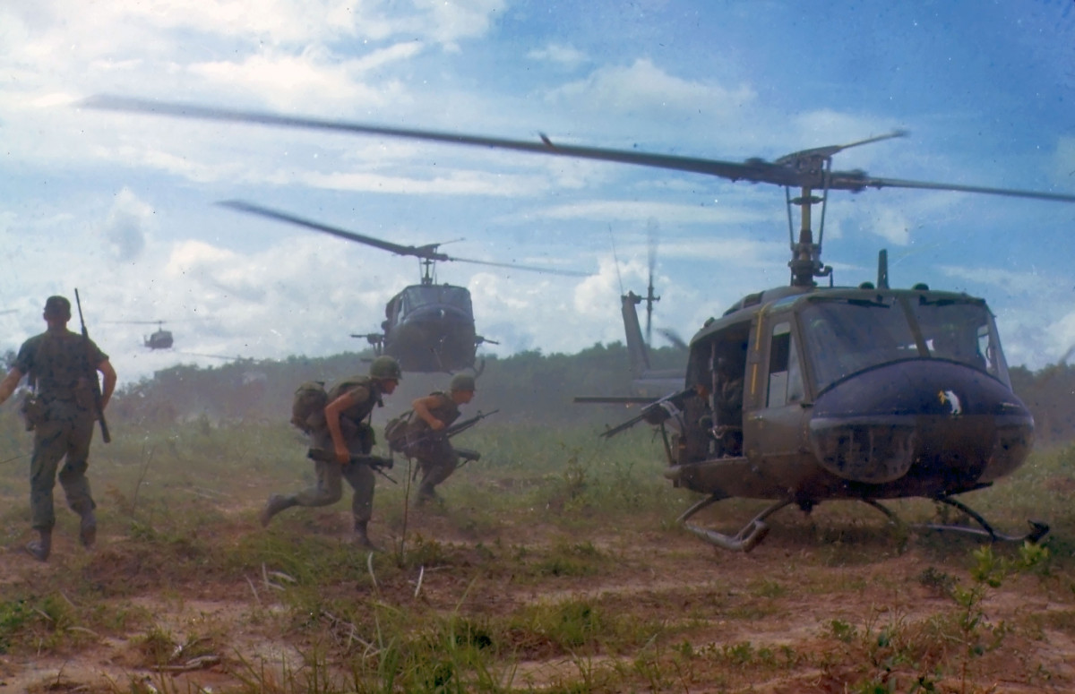
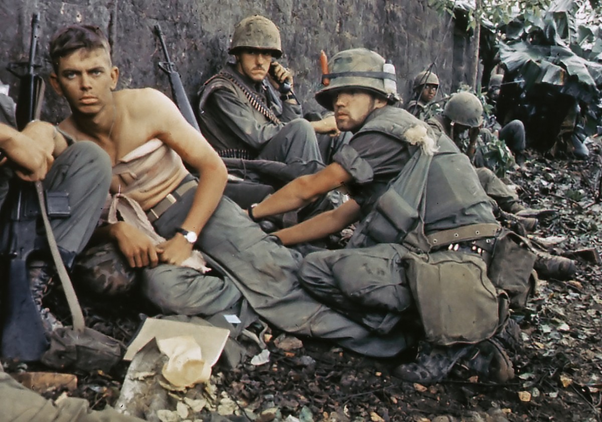 Monkey Amis with helicopters in
Vietnam 1966 [69] - Monkey Amis in Vietnam:
Marines are wounded 1967 [70]
["U.S." spy work - some remarks of the
"monkeys"]
<Naturally the war machinery of the [racist and
arrogant] Pentagon and the Saigon puppet
administration had made a great deal of effort to
find out the features of the strategic route of
North Viêt Nam. The following are some of their
remarks.
[Spy work of the monkey "U.S.A." 4 August 1965:
weapons of Vietcong coming from China and
Russia now]
<McNamara's 4 August 1965 report to the Defense
Sub-committee of the US Senate appropriations
commission writes:
"In 1963, a major part of the weapons introduced
from North Viêt Nam to the South was French and US
weapons acquired before 1954 in Indochina and Korea.
Now the armaments brought to South Viêt Nam are the
latest infantry weapons produced in Soviet Russia
and Communist China. Their quantity is so large
(p.66) that all units of the main forces may be
reequipped. In 1963 all the cadres and soldiers
infiltrated through Laos were South Vietnamese
previously regrouped to the North. They had been
trained and equipped in North Viêt Nam and ordered
to return to South Viêt Nam. Over the next 18
months, the greater part of the infiltrators (over
10,000 men) were North Vietnamese. Last December one
to two regiments of a North Vietnamese regular
division (Division 325) were introduced through
Laos. These units have been deployed in the plateau
region of Central South Viêt Nam to coordinate
fighting with the Vietcong.> (p.67)
[Spy work of the monkey "U.S.A." 17 December
1965: road net of HCM Trail supplies 2/3 of South
Vietnam military needs]
<In the December 17, 1965 issue of "Time"
magazine, an article called "More Troublesome Trail"
quoted General Creighton Abrams, the Vice Chief of
Staff of the US Army and the commanding general of
the U.S. Military Assistance Command, Viêt Nam
(MACV), as saying
"The road net can now move sufficient supplies to
meet the requirements of all North Vietnamese and
Viet Cong forces in the northern two-thirds of South
Viet Nam." (p.67)
(in: Time Magazine: More Troublesome Trail; 17
December 1965; Internet:
http://www.time.com/time/magazine/article/0,9171,834778,00.html
(3 July 2008)
[Example: Plei Me battle]
<The article further asserted that this was shown
through the intense fighting that occurred during
the last month around Plei Me in South Viet Nam,
where the North Vietnamese battled the U.S. 1st
Cavalry and used extensive supplies of
ammunition.> (p.67)
It states:
"Americans in Laos believe that it would take three
full U.S. divisions to stem the flow of men and
material from North Viet Nam. (Another two would be
needed to block South Viet Nam's narrow upper neck
at the 17th parallel). Eventually, the U.S. may well
have to come to Laos' rescue if it is to win the war
in South Viet Nam."> U(p.68)
(in: Time
Magazine: More Troublesome Trail; 17 December
1965; Internet:
http://www.time.com/time/magazine/article/0,9171,834778,00.html
(3 July 2008)
Monkey Amis in Vietnam: The siege of Plei Me with
wide-bodied helicopter [71]
Monkey Amis in Vietnam: gymnastic exercise on the
rope with large-capacity helicopter [72]
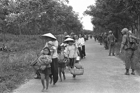
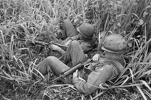
Siege of Plei Me: Vietnamese population is on the
run [73] -.
Siege of Plei Me: Monkey Amis lie in the grass
with machine gun [74].
[Spy work of the monkey "U.S.A.": plan 34A
against Vietnam - mentioning infiltration and
"jungle tracks"]
Under the plan coded 34A (US secret military
plan against North Viêt Nam), the activities
envisaged for 1964 were listed in detail:
-- spying flights over North Viêt Nam by U2 planes
-- kidnapping North Vietnamese citizens to get
information,
-- parachuting commandos and psychological war
agents to North Viêt Nam
-- surprise attacks from the sea
-- sabotage of railways, bridges and culverts
[little tunnels]
-- shelling [bombing and shooting] of coastal
equipment by patrol boats
-- attacks against North Laos and the Ho Chi Minh
Trail by the Lao Royal Air Force.
The Lao Royal Air Force has 30-40 T28 propelled
bombers but most of the pilots were Americans, only
a few were Lao. All were put under the control of US
Ambassador Leonard Anger resident in Laos. The same
"Time" article also writes:
"Since 1959, the 800-mile labyrinth of jungle
tracks, muddy rivers and bamboo way stations within
Laotian territory has been the major route south for
some 45,000 Communist infiltrators heading to battle
in South Viet Nam. The infiltration now comes to an
estimated 4,500 "bo doi" (regular infantry men) a
month. More than one third of the "trail" has been
converted into broad-shouldered (p.68), two-lane
dirt highways... several thousand North Vietnamese
soldiers are now permanently stationed in the
Laotian "panhandle" to keep the route secure.">
(p.69)
(in: Time
Magazine: More Troublesome Trail; 17 December
1965; Internet:
http://www.time.com/time/magazine/article/0,9171,834778,00.html
(3 July 2008)
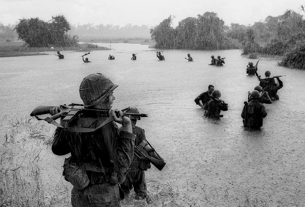
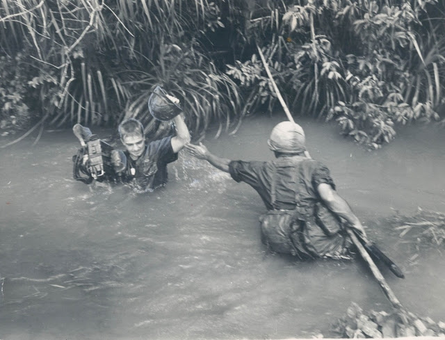 Monkey Amis in Vietnam: march in
the jungle in the rain at flooding [75] - Monkey
Amis in Vietnam: march in the jungle at flooding
Sep 25, 1965 [76].
What do these criminal foreigners want there?
[Monkey "U.S." command only sees a labyrinth]
<The war machinery in the Pentagon is well aware
of the role played by the strategic transport
corridor called "the Ho Chi Minh Trail". But as it
is described in a study on this trail, it
constitutes "a labyrinth across thick forests, an
impregnable and most secure secret zone of the
Vietcong."> (p.69)
This is the conclusion of the US [racist and
arrogant monkey] Defense Department on [concerning]
the network of roads in the Truòng Son Range.>
(p.69)
[Monkey "U.S.A." means that Ho Chi Minh
Trail would only be one road]
<In total, Americans only knew that the Ho Chi
Minh Trail started from Hanoi (Hà Nôi) and went to
Laos by the Mua Gia Pass, then it went down to
Shapone to reach the Dà Nang region. IN view of
these facts and details, the US could only carry out
indiscriminate bombings on the Truòng Son Range and
be resigned to a newer discovery (perhaps the only
accurate one) that "the Vietnamese never followed
the habitual road-way; they also never (p.107) chose
the large highways. All the newly constructed lines
are across mountains and forests and hey are
impenetrable." (p.108)
 Among the Yanks, the military
cemetery at Arlington near Washington DC is
filling up [77]
[Criminal "Christians" become dead bodies].


