Kontakt / contact     Hauptseite / page
                  principale / pagina principal / home     zurück / retour /
                  indietro / atrás / back
<<        >>
D  

Vietnam: Ho Chi Minh Trail 2:  The Ecological Environment and the Natural Museum

described by Khôi and Giói

"Trụng Son" [mountains]="Way to heaven" (S.18)
Vietnam: Trụng Son Mountain
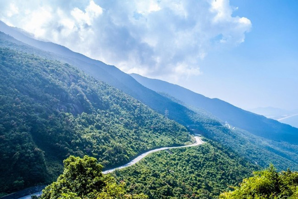
                    Range: slopes with street   Trụng Son Mountain Range in the
                    rainy season with fog   Mountains of Vietnam, sunset with some fog   Vietnam, weisse Orchidee   Vietnam,
                                Province of "Dak Lak", water
                                fall   Elephants in Vietnam
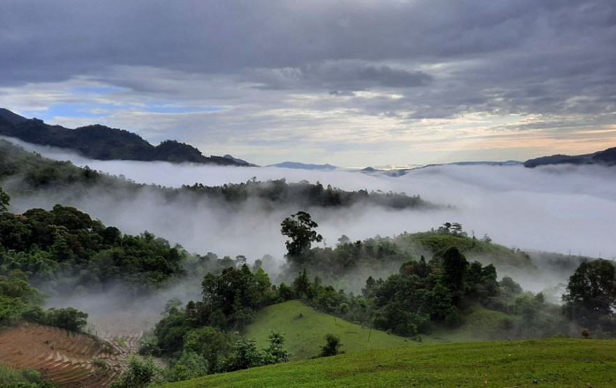
Vietnam: Trụng Son Mountain Range: slopes with street [1] - Trụng Son Mountain Range in the rainy season with fog [2] -
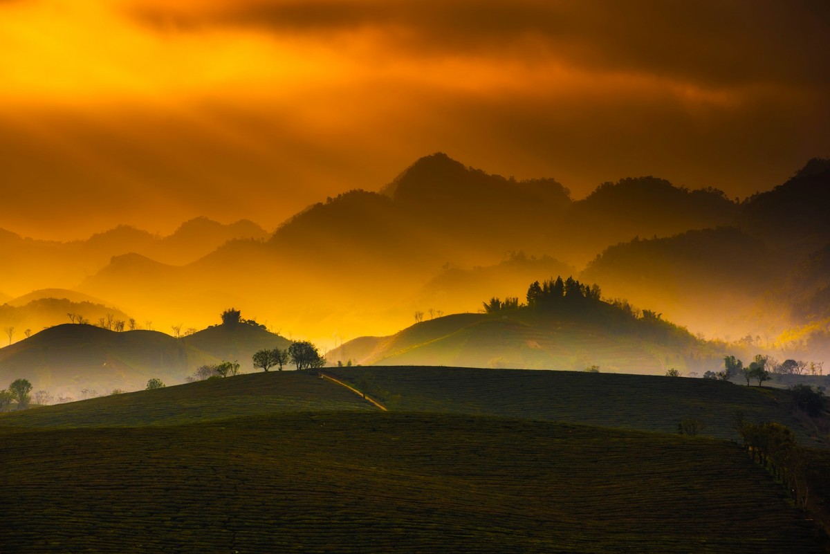
Mountains of Vietnam, sunset with some fog [3]
- Vietnam, white orchid [7] - Vietnam, Province of "Dak Lak", water fall [12] - Elephants in Vietnam [24]
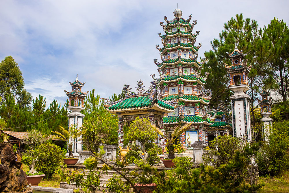
Vietnam, Tnung Lake with clouds mirroring   Vietnam, town of "Da Lat",
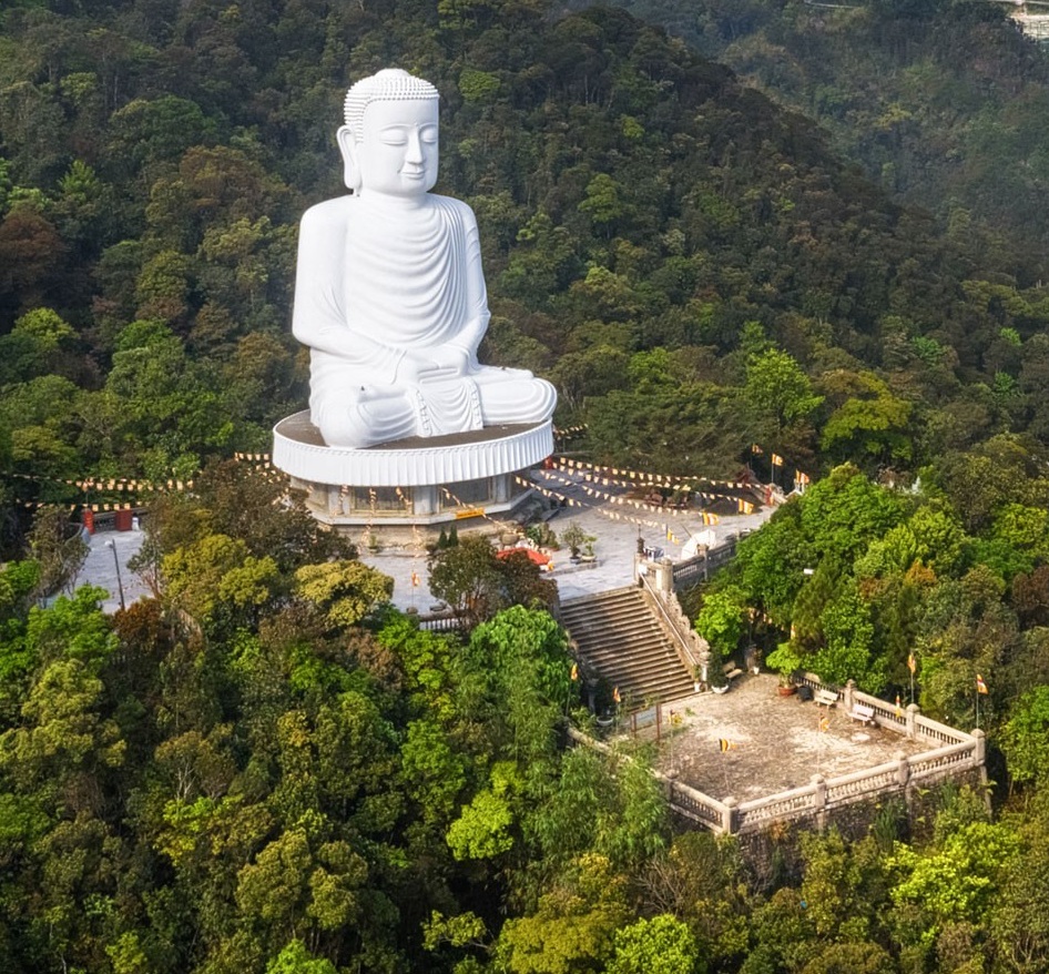
                            the Buddha Mountain with a white Buddha   Region of
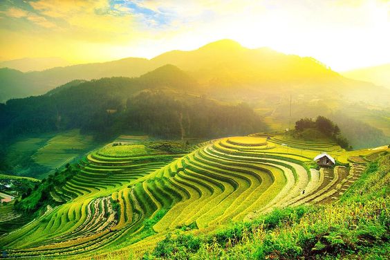
                          "Viet Bac" with rice terraces and
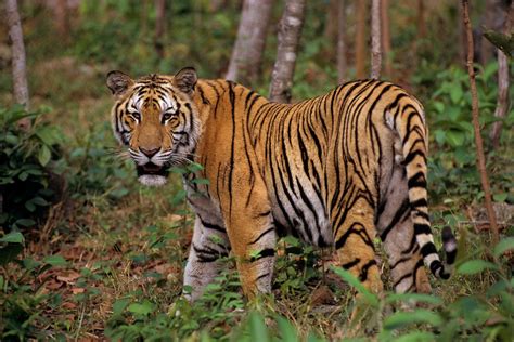
                          forest   Tiger in
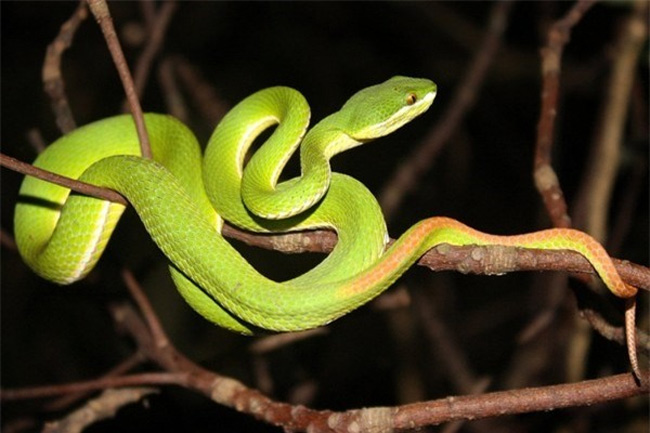
                                Vietnam   venenous snake in Vietnam:
                            white-lipped pit viper (lat.: Trimeresurus
                            albolabris)
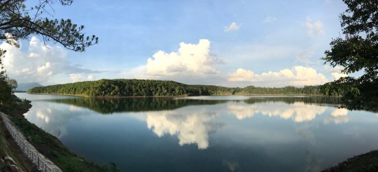
Vietnam, Tnung Lake with clouds mirroring [13]
- Vietnam, town of "Da Lat", the Buddha Mountain with a white Buddha [16]
Region of "Viet Bac" with rice terraces and forest [18] - Tiger in Vietnam [22] - venenous snake in Vietnam:
white-lipped pit viper (lat.: Trimeresurus albolabris) [23]

presented by
Michael Palomino (2013 - with photos 2023)

Share:

Facebook


from: The Hô Chí Minh Trail; Hoàng Khôi and Thê Giói Publishers 2008; English translation; first edition 2001; second edition 2008; printed in Viêt Nam; VN - TG - 6.149-1
[Rich nature in the mountain range of Trụng Son in Vietnam]

The Trụng Son range may be considered the backbone of Viêt Nam from which many 'ribs' originate and form lines or chains of mountains of different lengths, spreading from the plateau to the sea coast, thus dividing Central Viêt Nam into many plains, forests, mountains and population centers.

According to the parlance of Trụng Son soldiers, each main point of the range is a beauty spot. It may be a curve of the narrow path high on the precarious stone flank of the mountain, beside a deep abyss full of bramble and rugged rock; it may be a river watering place with aquatic plants billowing on the silvery current in a well-ventilated and spacious atmosphere. (p.13)

[Clouds]

Visiting Trụng Son, the tourist may admire the varying beauty of nature. In the morning, suddenly looking up, he can see an immense sea of white clouds floating, moving endlessly. He cannot say (p.13) where its limits are. He will wonder why and from where all the clouds are concentrated here! The snow white spongy clouds! He will be more surprised, if a few minutes later, looking up again, he will see only a vault of clear blue sky, all the clouds he thought endless, leave no trace now. The sun has risen. (p.14)

Vietnam: Trụng
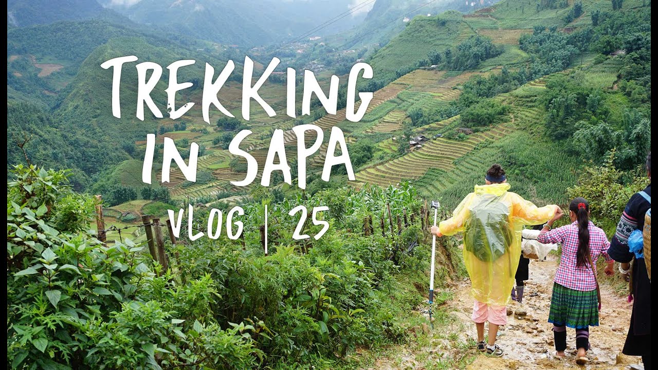
                          Son Mountain Range, Trecking in Sapa (Sa Pa)
Vietnam: Trụng Son Mountain Range, Trecking in Sapa (Sa Pa) [4]

[Forests and flowers]

The tourist will be also impressed by the primitive land of the plateau with thick forests where all kind of vegetation are entangled to form several layers. Bramble bushes, lianas, and creeping plants will make him think that there is no way to go forward. In the spring, walking on the Trụng Son, he will have the opportunity to admire flowers of all resplendent colors that Vietnamese botanists have yet succeeded in exhaustively listing. (p.14)

[Apricot flowers]

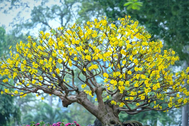
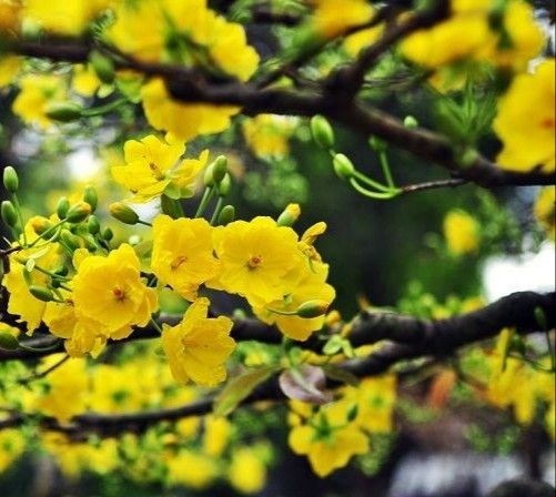
The most striking and impressive flowers in Trụng Son are the apricot flowers and orchids of various species. there are in Trụng Son four or five species of apricot flowers: the white ones are fragrant, the rose ones are reddish, the white-flowered apricot have fruit looking like longanes, and the yellow apricot flowers have a pervasive fragrance. When falling, their stems dry and the petals become a rose color, as if another kind of flower had replaced the fallen yellow ones. The yellow species are found all over the Trụng Son, from Nghê An to Eastern Nam Bô. Yellow apricots are highly appreciated because they are symbols of Spring. In Mai Lan, Huóng Hóa District, Thùa Thiên Huê Province, yellow apricots concentrate in the forests. (p.14)

Vietnam apricot tree with
                          apricot flowers   Vietnam apricot flowers zoom
Vietnam apricot tree with apricot flowers [5] - Vietnam apricot flowers zoom [6]

[Orchids and orchid traditions]

The forests of Trụng Son are endowed with many species of orchids that are very much liked (p.14) by the Vietnamese military, who take them to their trenches, to the cabins of their trucks, to their artillery fields. There are about a 100 species of orchids:
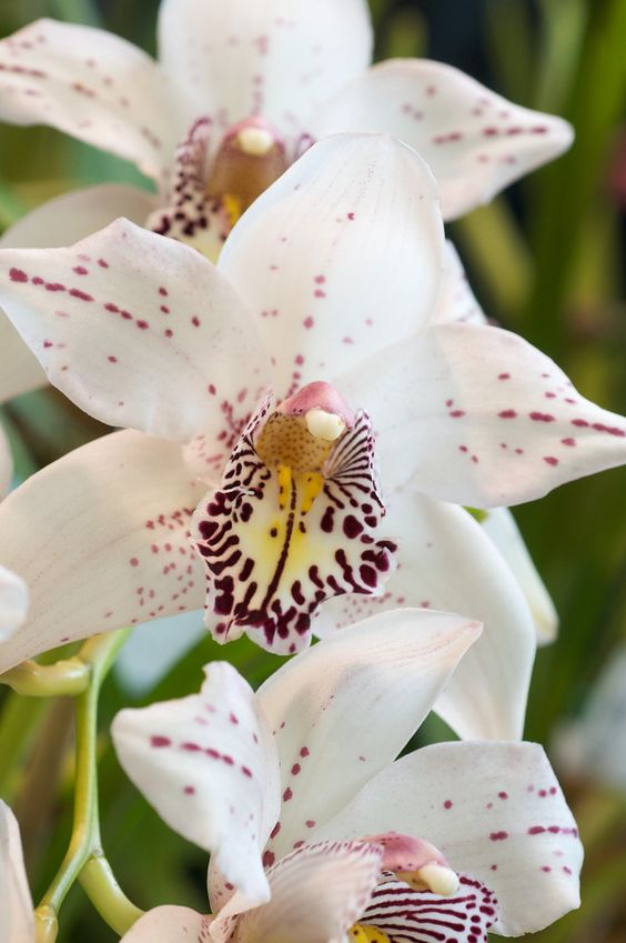
-- simple-petal rose-dotted white orchids,
-- simple-petal rose-dotted white orchids that look like a string of rubies,
-- flying-leaf brilliantly yellow orchids that look like a swarm of flaying butterflies,
-- Venus-shoe orchids that look like pretty little (rice) shoes,
-- the Kiêu-Dam Thanh green orchids that look very graceful and aristocratic,
-- foxtail shaped orchids,
-- scarlet squirrel-tail orchids,
-- rose weasel-tail orchids,
-- dragon-nail orchids,
-- maize orchids,
-- snake-scale orchids,
-- peacock-tail orchids, etc.

Vietnam,
                          white orchid
Vietnam, white orchid [7]


Some truck drivers camouflage their vehicles with orchids, a strange way of decoration indeed! Trụng Son orchids bloom in the spring and last very long, perhaps for months. The plateau A-tô-pu have orchids in abundance, particularly the buffalo ear orchids which grow on tall trees and on the steep slopes of mountains. Some of them are as long as 60 cm or 80 cm. (p.15)

[Caves, grottoes, and lakes in the mountain range Trụng Son of Vietnam]

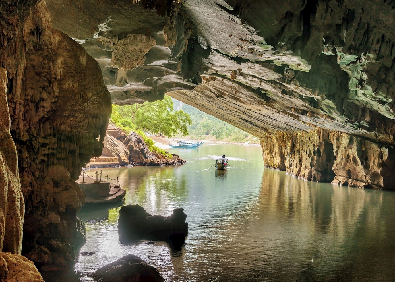
The Trụng Son range is rich in caves and grottoes: Phong Nha - underground grotto, Ng
ũ Hành - floating cave; and in lakes too: Lac Thiên, T'nung and others.

[This means that there are many caves for hiding which only know the natives and any intruder has no chance].

There are many places to stop along the way from North to South on the Trụng Son. There is the Phog Nha grotto in the mountain region of K
Bàng, in East Trụng Son, Quang B́nh Province. (p.15)

Vietnam, the caves of Phong Nha
 Vietnam, the caves of Phong Nha [8]

[K
Bàng mountains]

K
ẻ Bàng is an expanse of limestone mountains with steep flanks and dense forest. It is limited in the North by the Gianh river, in the (p.15) East by the Bô Trach district town about 30 km away, in the South by the Tiên Côc cave. (p.16)

[Phong Nha grotto with a high ceiling]

Access to the Phong Nha grotto is difficult. From Dông Hói, a town of Qu
ảng B́nh Province, one can take the road to Bô Trach and then follow the Trôc valley to reach Phong Nha, take a train from Ngân Son Station and then a boat for six hours to arrive at the entrance of the grotto, or take the train at Thu Lôc Station and walk 20 km. Boats sail along the Trôc river to Hà Môn village, which is 300 km only from Phong Nha, from where one can already see the entrance. The initial sighting, though, is disappointing because a declivity of the mountain resembling a stone hammock seemingly bars the entrance of the cave. Yet, when the boat cautiously approaches the stone hammock, the ceiling of the cave surprisingly seems to rise tens of meters (p.16) .

The Phong Nha grotto includes 14 large, connected compartments, with a total length of 1,500 m, and several smaller compartments, with a total length of a few hundred meters. The grotto has been formed by the erosion of limestone by the Chài underground stream, which is a portion of the Nam Aki River in the open air. The Nam Aki River also flows underground at the Pu-Pha-
Dam mountain region, 20 km away from Phong Nha to the South. Further into the grotto, the ceiling becomes higher, especially from the fourth compartment onward where the ceiling is 20 m to 40 m above ground. The beauty of Phong Nha comes from its stalagmites and stalactites, which are strangely shaped and magnificently and variously colored by the sunlight that comes (p.16) through holes in the grotto ceiling and are reflected from the indigo-colors water current on the grotto floor. The tourist will hear the strange sounds of the winds blowing in the grotto like the music of an orchestra of flutes, then the twittering of birds reverberating from the walls of the cave. He will find stone as flat as chess boards or human-shaped rocks, or strings of rock as beautiful as jade necklaces. Phong Nha is a beauty spot created by the geological structure of the Trụng Son range. (p.17)

[The region of Ng
ũ Hành Son]

The Ng
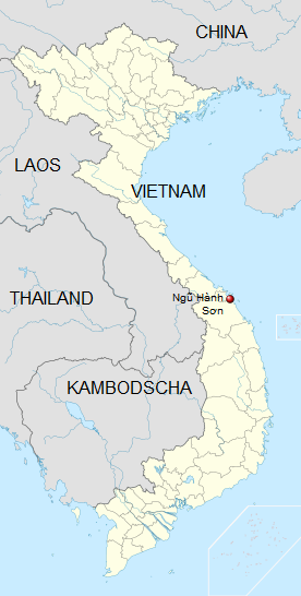
ũ Hành Son is also east of Trụng Son, about 30 km away. Looking from the Eastern Sea, Ngũ Hành Son and Trụng Son form a single continuous mass, Ngũ Hành Son being the part of Trụng Son that adjoins the sea in Quảng Nam Province. This is a scenic spot of Viêt Nam. It is composed of five peaks in the Ḥa Vang District, Quảng Nam Province. The Hàn river flows in the west of this group of mountains, the ocean borders [?] it in the East. (p.17)

[Grottoes in the
Ngũ Hành Son region - marble mountain]

"Ng
ũ Hành Son" ["marble mountain" - link] is also called the Non Nuóc Mountain. It contains many
beautiful caves and grottoes of marble bearing beautiful names: Vàn Nguyêt, Thiên Long, Linh Nham. Some grottoes are opened, others are underground: The Heavenly Grotto and the Windy Cave (where the wind blows all the year round). Particularly the Huyên Không grotto is about 30 m2 and over 30 m high; it has five openings through which the sky is visible, the grotto walls are shaped like women's breasts, with water dripping all year long from the larger breasts. (p.17)

Vietnam, marble mountains in the region
                          of "Ngu Hanh Son", panoramic photo
Vietnam, marble mountains in the region of "Ngu Hanh Son", panoramic photo [9]
The 5 marble mountains are said to be called after 5 elements: Kim (metal), Thuy (water), Moc (wood), Hoa (fire) and Tho (earth). - Link

[
Ngũ Hành Son region with orchids and tower pagodas]

In Ng
ũ Hành Son, there are plenty or orchids and many tower-pagodas, for the cult of (p.17) Brahmanism (an Indian religion introduced into Viêt Nam long ago). Some pagodas contain many Buddha statues that, though simple they are made from precious marble by skilled craftsmen. (p.18)

[
Ngũ Hành Son region with more towers]

In
Ngũ Hành Son, besides pagodas there are also many towers, like the sea watching tower in the East and the river-watching tower in the West. They can be reached by long flights of stairs (as many as 105 steps). From the sea watching tower, one can see as far as the Chàm Isle in the Eastern Sea. From the river watching tower, one can see the Hàn river, the rice fields of Dà Nang, and the Bà Ná Mountain looming dimly in the while fog of Trụng Son. (p.18)

Vietnam, the region of
                          "Ngu Hanh Son", map
Vietnam, the region of "Ngu Hanh Son", map [10]

[
Ngũ Hành Son region with colored stone]

It is noticeable that besides different kinds of finely veined marble,
Ngũ Hành Son is also the quarry of white stone and orange stone. Because of the availability of stone, the local population is made up of professional stone carvers turning out art works from the mountain stone. Here, one will be shown the 'Way to Heaven' (to the Trụng Son) and the 'Way to Hell' (to the Eastern Sea) to which, from 1947 onward, the guerrillas of Qung Ngăi and Dà Nang used to withdraw when encircled by the enemy. (p.18)

[Tây Nguyên plateau]
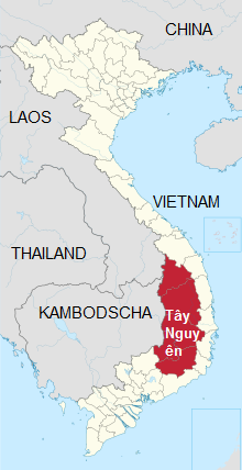
The Tây Nguyên plateau region offers many beautiful stops created by natural lakes, like Lák, T'nung. (p.18)

Map of Vietnam with the plateau of
                          "Tay Nguyen" in South Vietnam     
Map of Vietnam with the plateau of "Tay Nguyen" in South Vietnam [11]


[Dác Lác Province with Lák lake - summer house of Bao Dai]

Lák lake in Lak District, Dác Lác Province. From Buôn Ma Thuôt, following Highway 21A, one will arrive at the village of Yang Réh. To the right and across the Lac Thiên Pass is the Lac Thiên townlet about 10 km away. The road meanders among green vegetation and various (p.18) fragrant flowers. The townlet spreads beside the lake, on low hills in the East and the South. In the North and the West are distant mountains. The low places occupied by the fields and the villages of the ethnic groups of Tây Nguyên, appear in the shade of the "Co Nia", the coconut, and the bamboo trees.

Vietnam,
                            "Dak Lak" Province, water fall  
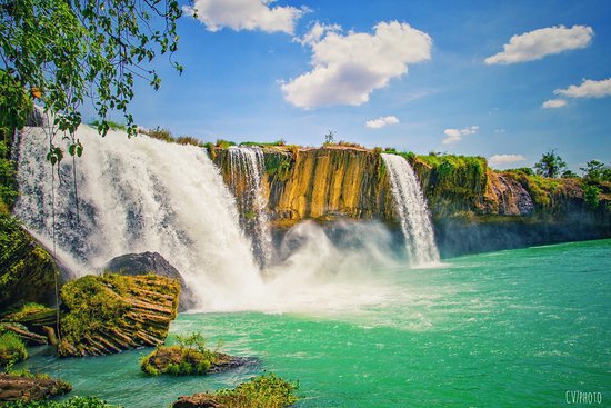
Vietnam, "Dak Lak" Province, water fall [12]


Near Lák Lake there stands the summer house of Bao Dai, the last feudal king of Viêt Nam. The lake surrounds the Lac Thiên  townlet, and is a huge water reserve for the local population and for the cultivation of rice in this region. It is also full of lotus flower and fish, constituting an important source of income and food for the local people. (p.19)

[Legends about the Lák Lake]

Lák Lake has a great number of legends, including one about a boy from the Mo Nông ethnic group who found a precious sword to kill a cruel king and save his people, or one about Dam Thi who, together with the Lao, the Kinh, and the Êdê, recovered all the parts of a sacred sword to fight their common enemy and to kill ferocious wild animals. (p.19)

[Pleicu Province with T'nung Lake]
T'nung Lake, considered a gem of Pleicu Province, is at an important crossroad of Tây Nguyên. From Pleicu town, following road Nº 14, one will reach Kontum, Quang Nam, Thùa Thiên in the North, and Buôn Ma Thuôt, Di Linh in the South. Road Nº 19 then leads to Cambodia in the West and B́nh Dinh, Qui Nhon in the East. The way to go to T'nung is really convenient. T'nung Lake is 7 km distant from Pleiku on the right, in the North (p.19).

Vietnam, Tnung Lake with
                          clowds mirroring  
Vietnam, Tnung Lake with clowds mirroring [13]


The lake, which is a former volcanic crater, is in the middle of a region of undulating hills. It is (p.19) difficult to say whether it is square or round, each of its sides is about 2 km long and its deepest point is 36 m below the surface. The path leading to the lake is full of flowers. On the banks is a whole forest of Eban flowers, milk-white flowers making brilliant dots in an azure atmosphere. The lake is also magnificently ornamented by "mua", yellow "ngai", waterlily and lotus flowers. In the surroundings, there are many species of valuable and rare birds, such as the D'rao, the Trac-ta, the Co-túc, the Co-vong, twittering among flower bushes. T'nung Lake is the supplier of fish to the whole Pleicu Province. (p.20)

[Da Lat in the south of the mountain range of Trụng Son]

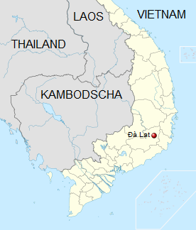
Map of Vietnam with "Da Lat"   Vietnam, town of "Da
                          Lat" with pagoda (Buddha grave)
                          "Linh Son"   Vietnam,
                          "Da Lat" with Buddha Mountain with a
                          white Buddha
Map of Vietnam with "Da Lat" [14] - Vietnam, town of "Da Lat" with pagoda (Buddha grave) "Linh Son" [15] - Vietnam, "Da Lat" with Buddha Mountain with a white Buddha [16]

The summer resort city of Dà Lat lies in South Trụng Son, on the Lang Biang plateau, between two 2,000-high mountain chains: the Chu-Yang-Xin in the North and the Lang Biang peak in the South. Dà Lat is 1,500 km above sea level with year-long cool climate. Dà Lat forms a knot of communication lines in the plateau region of Central Viêt Nam. About 30 km from Dà Lat are waterfalls with about 10 medium or small hydro-electric works. In the city itself can be found expanses of forests and tens of beautifully named lakes, like Than Tho (Moaning Lake) and Xyân Huong (Spring Perfume Lake), and Ái Ân (Tender Love) forest.

There are also many lakes here. Some are as large as 4 km2. Dà Lat is an important producer of all kinds of flowers and vegetables. (p.20)

[Best soil in the mountain range of Trụng Son]

Trụng Son is a long and wide part of the country. The soil found in Trụng Son, particularly that in the highlands, is considered by Vietnamese pedologists to be the most fertile soil in Viêt Nam. The basalt in Trụng Son (p.20) accounts for 65% of all the basalt in Viêt Nam. It is because of Trụng Son that Viêt Nam has the immense green forests and vegetation that grow along its borders. (p.21)

[Industrial crops in the mountain range of Trụng Son - tea, rubber, coffee, vegetables, fruits peanuts, sesame, bananas, sugar cane, soya, cacao, pepper, medicinal plants - lissome grass, rice fields, cassava, maize]

Trụng Son forests are spread out from West Nghê An - Hà Tính to the extreme South of Central  Viêt Nam, the Di Linh plateau, with different kinds of soil and rock. Besides volcanic red earth, Trụng Son still has gray, brown, and yellow soils, as well as alluvions. These fertile soils are used for the cultivation of industrial crops (tea, rubber, coffee), vegetables, and fruit trees. Cultivable basalt lands in the Trụng Son from West Nghê An - Hà Tính to Eastern Nam Bô cover as much as 2 million ha, on which are grown peanuts, sesame, bananas, sugar cane, soya beans, cacao, pepper and medicinal plants.

Trụng Son is mainly covered by forests and grass lands. The large meadows of lissome grass are alternated with patches of rice field and, on the banks of rivers in the valleys, are terraces fields of cassava or of maize. (p.21)

[Nomadic life in the past because of the dry season]

Thanks to fertile land and abundant water sources from thousands of rivers and streams that flow to the lakes and ponds, [the mountain range of] Trụng Son, though difficult to access, is humid year-round with permanently-green forests. Lakes and ponds are pockets of fresh water that preserve the ecological environment of the whole plateau region. A puzzle for generations in [the mountain range of] Trụng Son, it was previously unknown why water was abundant during the rain season but so sparse during the dry season (p.21). Because of the shortage of water, the population of [the mountain range of] Trụng Son led a nomadic life. Their permanent aspirations were evidenced by their village names: Dác Lác, Dác Minh, Dác Sút, Dác Pao ("Dác" means "water"). (p.22)

[Reservoirs evade shortage of water]

Today, it is known that actually the too-abrupt slope of East Trụng Son and the clefts in the mountain blocks are the causes of the water shortage. Therefore large lakes have been built to store water for the dry season and for the operation of hydroelectric plants. (p.22)

[Wood, medicinal plants and rare animals in the mountains of the Trụng Son mountain range - wild and planted forests]

The forests of Trụng Son account for as much as 4/5 of the area of the range and contain precious wood (ironwood, sindora, barian kingwood, "po-mu") and valuable medicinal plants.

The fauna is also rich in rare animals.

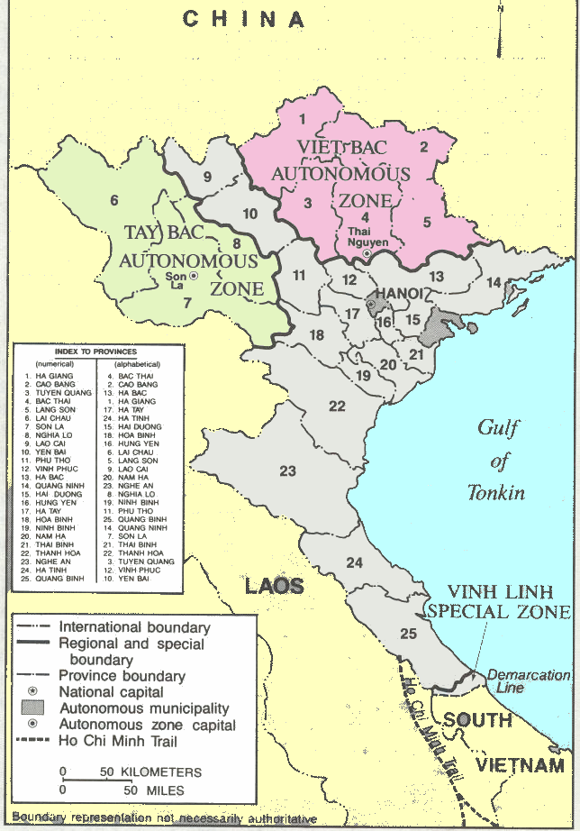
There are two kinds of forests in Trụng Son: wild and plated. Both contribute to the ecological balance needed for the survival of 30 ethnic minority groups of Viêt Nam and once played an important role in the resistance wars against France and the US, like the forests in Viêt Bác and Tây Bác, in North Viêt Nam. they cover the Hô Chí Minh Trail. Without the position of the Trụng Son Range and its immense forests, the construction of the Hô Chí Minh Trail would have been impossible. (p.22)

Map of North Vietnam with
                          Hanoi and the regions "Viet Bac" and
                          "Tay Bac"   Vietnam
                          region of "Viet Bac" with rice
                          terraces and forest  
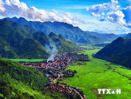
Map of North Vietnam with Hanoi and the regions "Viet Bac" and "Tay Bac" [17] - region of "Viet Bac" with rice terraces and forest [18]
Vietnam
                          Region of "Tay Bac" with rice
                          terraces and forest   Vietnam, town of "Hà Giang"
                            in the mountains of "Tay Bac"   
Vietnam: region of "Tay Bac" with rice terraces and forest [19] - Vietnam, town of "Hà Giang" in the mountains of "Tay Bac" [20]

[Variety of animals in different conditions]

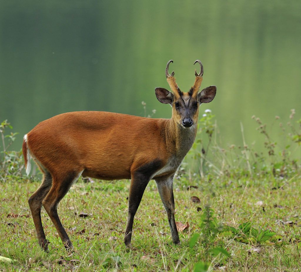
Each species of animals in the Trụng Son has a particular living environment that it prefers. Some, like tiers, choose to live in alang-grassed hills, while others, like monkeys like clusters of tall trees in the cool shade, and still others live in thin forests, on rocky mountains, or in remote (p.22) places rarely visited by men. In general, the fauna in the Trụng Son consists mainly of animals of tropical regions: tigers, panthers, gibbons, squirrels, monkeys, otters, pangolins, deer, and muntjac (p.23).

[Animals: muntjac]
Muntjacs are gentle and timid. When meeting a wolf, a muntjac will lean its head against a tree and kick aimlessly and vigorously with its hind legs at the wolf that is attacking it. Its legs may be wounded and bleeding but it will never give up. This is the strange way a muntjac defends itself
(p.23).

Muntjac
Muntjac [21]


[Animals: boars]

Boars also have a peculiar way of fighting wolves. Hearing the howling of wolves, a boar runs towards them and, from a distance, faces the leader of the pack. With its pointed tusks, it lifts up the wolf and flails it against the ground. After seeing this, the rest of the wolf pack would run away
(p.23).

[Animals: tigers and snakes]
Each species of animals has its specific way of living. On moonlight nights, a tiger is inclined to sit quietly on the bank of a stream to admire the glistening reflection of the moon on the current, to stretch its legs and catch the moon, forgetting about the search for prey. Harmless and ferocious animals in Trụng Son are numerous. But the local population, including the soldiers, know how to overwhelm or tame them, even venomous snakes whose bite is fatal. [venomous snakes in Vietnam - link (English)]. But how can they be caught alive? (p.23)

Tiger in
                          Vietnam   poisonous snake in Vietnam:
                          white-lipped pit viper (lat.: Trimeresurus
                          albolabris)
Tiger in Vietnam [22] - poisonous snake in Vietnam: white-lipped pit viper (lat.: Trimeresurus albolabris) [23]


When meeting a snake, the traveler in Trụng Son (who always has his turban if he is a civilian, or his water-fern shaped cap if he is a soldier) will run around and let the snake pursue him. In doing so he will get nearer the tail and swing the snake round quickly to make it dizzy (p.23). Then with the other hand he will grab its head, break its teeth and render it harmless. Other kinds of snake run away when disturbed. Then the man will brandish his turban (or his cap) and approach the snake. Out of curiosity, the snake raises its head and looks. The man will choose the opportune moment to snatch its neck and have it. Another way to catch a snake is to use dried cassava flour. When it appears, the traveler will powder his hands and feet with cassava flour. At the smell of the flour, the snake will remain immobile and let itself be caught. (p.24)

[Tamed elephants also for Ho Chi Minh Trail]
Elephants of Trụng Son are noteworthy. In the 18th century the Tây Son brothers tamed elephants for transport and battle purposes. During and after the resistance wars against the French and the US, Viêt Nam used thousands of elephants for the transport of supplies and for the construction of the Hô Chí Minh Trail. Though not as big as the African elephant, the Trụng Son one is 3 m tall, weights 4 to 5 tons, and can run at a speed of 35 to 40 km/hour.

Elephants in
                          Vietnam
Elephants in Vietnam [24]


To fight tigers, they kick, twist the tiger's tail with their trunks, and lift them up. Elephants deeply hate wolves, which they kill by picking them up and drowning them in water or flailing them against big trees. (p.24)

[Elephant burials - digging a grave, covering it and planting banana plants on it]
Elephants are faithful towards other elephants and men.

[But elephants can be also dangerous for human beings, also when they are tamed. They can take the human being with their trunk flailing them against walls and trees - as a "joke". Thailand with regular elephant tourism deplores approximately every month one dead by elephants. Example from Vietnam: link].

When one member of their herd dies, all the herd carry the body of the dead with their trunks and trumpet noisily while walking. They use water to soften the soil of the burial place and dig a grave with their legs. They put the dead elephant into the cavity, fill it up with earth, and wipe out all traces (p.24) with trees branches and leaves. Finally, they bring in bananas to plant on the grave. They wait until the bananas take roots before leaving the place to look for other habitats (p.25).

Towards man, the Trụng Son elephant harbors deep emotions. Once, an old elephant happened to meet its old master again (formerly, when young and sturdy, it had worked pulling wood for him) who was bivouacking with other combatants on their way to the front. The soldiers were frightened when the old elephant appeared. The old guide murmured to the elephant, and the animal knelt down and affectionately touched the head and shoulders of its old master. For several consecutive days, it patiently followed the troops, now and then it trumpeted the sound reverberating to signal its presence or to drive away other wild animals. (p.25)

[Legends in the mountain range of Vietnam]
There are many strange stories about the fauna of Trụng Son. The local population will tell them all to visitors. (p.25)

<<         >>


Poto sources

[1] Trụng Son Mountain Range: slope with street: http://www.vietvisiontravel.com/post/truong-son-range-day-truong-son/
[2] Vietnam: Trụng Son Mountain Range in the rainy season in the fog:
https://vietreader.com/travel/48893-photo-cloudy-season-on-truong-son-mountain-range.html
[3] Mountains of Vietnam, sunset with some fog: https://pxhere.com/en/photo/1391341
[4] Vietnam: Trụng Son Mountain Range, trecking in Sapa (Sa Pa): https://www.youtube.com/watch?v=jNtty2jIRBs
[5] Vietnam apricot tree with apricot flowers:
https://www.dreamstime.com/apricot-flowers-blooming-vietnam-lunar-new-year-apricot-flowers-blooming-vietnam-lunar-new-year-yellow-blooming-image112307329
[6] Vietnam apricot flowers zoom: https://www.pinterest.com/pin/743516219740251227/
[7] Vietnam, white orchid: https://www.pinterest.com/pin/781867185310092236/
[8] Vietnam, the caves of Phong Nha: https://www.audleytravel.com/us/vietnam/country-guides/phong-nha-caves
[9] Vietnam, the marble mountains in the region of "Ngu Hanh Son", panoramic photo: https://en.wikipedia.org/wiki/Marble_Mountains_(Vietnam)
[10] Vietnam, the region of "Ngu Hanh Son", map: https://vi.wikipedia.org/wiki/Ng%C5%A9_H%C3%A0nh_S%C6%A1n_%28qu%E1%BA%ADn%29
 
[11] https://de.wikipedia.org/wiki/T%C3%A2y_Nguy%C3%AAn
[12] Vietnam, the province of "Da Lak", water fall: https://www.tripadvisor.com.au/Tourism-g1633422-Dak_Lak_Province-Vacations.html
[13] Vietnam, Tnung Lake with clouds mirroring:
https://www.tripadvisor.fr/Attraction_Review-g1224292-d1674539-Reviews-T_Nung_Lake_Ia_Nueng-Pleiku_Gia_Lai_Province.html
[14] Vietnam, map with the town of "Da Lat": https://de.wikipedia.org/wiki/%C4%90%C3%A0_L%E1%BA%A1t
[15] Vietnam, town of "Da Lat", pagoda: https://touringhighlights.com/things-to-do-in-da-lat-vietnam/
[16] Vietnam, town of "Da Lat", Buddha mountain with a white Buddha: https://www.aftravel.com.my/tour/land-only/vietnam/da-lat/da-lat-4d3n-highlight-of-vietnam
[17] Map of North Vietnam with "Viet Bac" and "Tay Bac":
https://www.globalsecurity.org/jhtml/jframe.html#https://www.globalsecurity.org/military/world/vietnam/images/drv-map-1966.gif|||
[18] Vietnam, the region of "Viet Bac" with rice terraces and forest: https://upes2.edu.vn/phan-tich-bai-viet-bac-lop-12/
[19] Vietnam, the region of "Tay Bac" with rice terraces and forest: https://www.pinterest.com/pin/680043612456503012/
[20] Vietnam, town of "Hà Giang" in the "Tay Bac" mountains:
https://dantri.com.vn/du-lich/hoi-cho-du-lich-tay-bac-lan-dau-tien-sap-dien-ra-tai-ha-giang-1413258054.htm

[21] Muntjac animal: https://ptes.org/get-involved/surveys/garden/living-with-mammals/muntiacus-muntjak-or-feas-barking-deer-also-called-feas-muntja/
[22] Tiger in Vietnam: https://saigoneer.com/vietnam-news/5307-vietnam-is-down-to-its-last-20-indochinese-tigers
[23] Venenous snake Vietnam: white-lipped pit viper (lat.: Trimeresurus albolabris): https://scienceinfo.net/poisonous-snakes-in-vietnam.html
[24] Elephants in Vietnam: https://ramblingj.com/are-there-elephants-in-vietnam/
^